Latitude: 53.4267 / 53°25'36"N
Longitude: -1.0144 / 1°0'51"W
OS Eastings: 465586
OS Northings: 392669
OS Grid: SK655926
Mapcode National: GBR PXCT.5B
Mapcode Global: WHFFV.D45B
Plus Code: 9C5WCXGP+M6
Entry Name: Bawtry Bridge
Listing Date: 11 January 1988
Grade: II
Source: Historic England
Source ID: 1314826
English Heritage Legacy ID: 334715
ID on this website: 101314826
Location: Bawtry, Doncaster, South Yorkshire, DN10
County: Doncaster
Civil Parish: Scaftworth
Built-Up Area: Bawtry
Traditional County: Nottinghamshire
Lieutenancy Area (Ceremonial County): South Yorkshire
Church of England Parish: Everton
Church of England Diocese: Southwell and Nottingham
SK69SE
10/16
27 November 1984
BAWTRY
GAINSBOROUGH ROAD
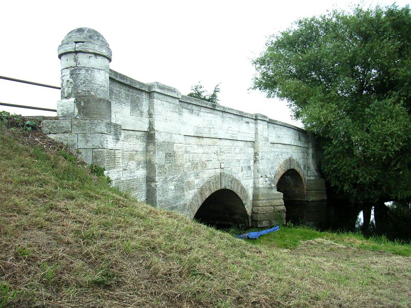
Bawtry Bridge
II
Bridge. 1810; builder Mr. Flavel of Wetherby (Peck, p 13); widened 1940.
Rock-faced gritstone voussoirs; horizontally-tooled magnesian limestone
walling. 3 segmental arches with projecting keystones; the central arch
larger and flanked by triangular cutwaters; the outer arches flanked by
buttresses. Both cut waters and buttresses rise to the parapet as projecting
piers linked by a cambered band which continues across wing walls terminating
in cylindrical piers set on square bases. Domed parapet copings. South
side, dated 1940, is the re-used facade of 1810; north parapet, facing road,
is inscribed Y/N denoting the county boundary. Built for £3,000 on a
foundation of 144 piles overlain by 2 thicknesses of planks. Partly in the
parish of Scaftworth in the County of Nottinghamshire.
W. Peck, Bawtry and Thorne, 1813.
Listing NGR: SK 65586 92669


Other nearby listed buildings