Latitude: 53.7081 / 53°42'29"N
Longitude: -1.9121 / 1°54'43"W
OS Eastings: 405898
OS Northings: 423524
OS Grid: SE058235
Mapcode National: GBR HT2K.TH
Mapcode Global: WHB8N.L2P3
Plus Code: 9C5WP35Q+65
Entry Name: County Bridge
Listing Date: 19 July 1988
Grade: II
Source: Historic England
Source ID: 1313739
English Heritage Legacy ID: 339412
ID on this website: 101313739
Location: Friendly, Calderdale, West Yorkshire, HX6
County: Calderdale
Electoral Ward/Division: Sowerby Bridge
Parish: Non Civil Parish
Built-Up Area: Halifax
Traditional County: Yorkshire
Lieutenancy Area (Ceremonial County): West Yorkshire
Church of England Parish: Sowerby Bridge Christ Church
Church of England Diocese: Leeds
Tagged with: Bridge
This list entry was subjected to a Minor Enhancement 11 June 2024 to amend details in the description add Historical Note and Sources
SE 0423 and SE 0523
12/280
SOWERBY BRIDGE
TOWN HALL STREET
County Bridge
GV
II
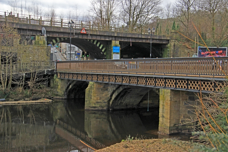
Road bridge across the River Calder. First stone bridge 1517, widened 1632 and again 1875.
Coursed squared stone and cast iron. The stone bridge is of three shallow segmental arches supported on piers with triangular-section cutwaters, some of the cutwaters having been rebuilt. These arches are now recessed beneath the 1875 superstructure that widened the bridge deck. This superstructure consists of lattice girders that span between the stone cutwaters on the eastern side and are supported by round iron piers on the western side. The bridge has cast iron balustrades formed by pierced panels, the piercings being regularly and closely spaced with rounded tops and bases. The balustrades have panelled end posts with finials.
Listing NGR: SE0589823524
The town of Sowerby Bridge was named after the bridge across the Calder, the earliest reference perhaps being 1424 in the Wakefield Manor court roll which refers to ‘Sourby-brig’ although there was an earlier reference to a wooden bridge here in 1315. The 1517 date for the stone bridge comes from a record of a bequest from John Dykson for ‘the fabric of the stone bridge at Sowerby six shillings and eight pence’. The local antiquarian H A Kendal, writing in 1915, argued that the arches at either end of the bridge include the arches of the C16 bridge, the central arch having been rebuilt after flood damage in 1673 resulted in the removal of a central pier, the bridge having been already widened in 1632. More recent survey and documentary research (2011) suggests that the earliest exposed stonework probably dates to the mid-C17, the bridge being depicted in Robert Carr and John Watson’s ‘A Book of Bridges’, the bridge subsequently being widened sometime between 1752 and 1823, probably with the establishment of the Halifax and Rochdale Turnpike Road in the 1790s. Further work to the bridge appears to have occurred in 1823 with the purchase of land to the north-east previously occupied by a chapel, this work possibly relating to wing walls and cutwaters. Responsibility for the bridge passed to the West Riding in 1875, after which the bridge became known as County Bridge. Around this time the bridge was widened with an iron superstructure. Further widening was proposed in 1876 and approved in 1878 but may not have been undertaken. In 1979 a retaining wall collapsed revealing the earlier stonework within the core of the bridge.
External links are from the relevant listing authority and, where applicable, Wikidata. Wikidata IDs may be related buildings as well as this specific building. If you want to add or update a link, you will need to do so by editing the Wikidata entry.


Other nearby listed buildings