Latitude: 53.0934 / 53°5'36"N
Longitude: -2.6443 / 2°38'39"W
OS Eastings: 356951
OS Northings: 355324
OS Grid: SJ569553
Mapcode National: GBR 7N.9068
Mapcode Global: WH9B2.CH2X
Plus Code: 9C5V39V4+97
Entry Name: The Bath House
Listing Date: 12 January 1967
Grade: II*
Source: Historic England
Source ID: 1312873
English Heritage Legacy ID: 56816
ID on this website: 101312873
Location: Haughton, Cheshire East, Cheshire, CW6
County: Cheshire East
Civil Parish: Spurstow
Traditional County: Cheshire
Lieutenancy Area (Ceremonial County): Cheshire
Church of England Parish: Bunbury St Boniface
Church of England Diocese: Chester
Tagged with: House
SJ 55 NE SPURSTOW C.P.
2/57 The Bath House
12 January 1967 II*
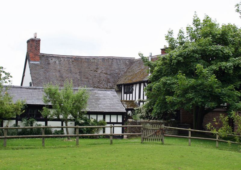
Farmhouse, late C16. Plastered and brick nogged timber frame with tile roof, 2 storeys, 3 window bays with 3-bay return (north). High sandstone plinth. Close studding, in heavy timbers, with rails only to windows. Angle braces, west gable jettied at first floor and apex. Large sandstone stack to rear (south) with diagonally set flues. Flush casements with glazing bars. French window on the garden front (east). The west gable has timber in the chevron style with struts from the king post and three struts from the tie beam each side; the east gable has a similar arrangement painted on the plastered apex. There is a gable end stack to the north wing. The boarded entrance door is in the north-west angle of the building. Interior: Heavy ovolo moulded beams and square section joists in all ground floor rooms. Old boarded door. Georgian cast iron mantel. At first floor two oak Elizabethan 6-panel doors on "H" hinges with remains of older wrought hinges, latches and oak cased lock. Wide oak flooring. Wide oak staircase with turned newel and one 75mm turned baluster per tread, fixed between timber framed internal walls. Truss with curved tie beam and two posts, wide ceiling joists. House said to have been used to accommodate visitors to a salt spring in an adjoining field.
Listing NGR: SJ5695155324
External links are from the relevant listing authority and, where applicable, Wikidata. Wikidata IDs may be related buildings as well as this specific building. If you want to add or update a link, you will need to do so by editing the Wikidata entry.


Other nearby listed buildings