Latitude: 50.2163 / 50°12'58"N
Longitude: -5.4791 / 5°28'44"W
OS Eastings: 151897
OS Northings: 40942
OS Grid: SW518409
Mapcode National: GBR DXV3.H22
Mapcode Global: VH12D.ZT8J
Plus Code: 9C2P6G8C+G8
Entry Name: Porthmeor Beach Flats
Listing Date: 4 June 1952
Grade: II
Source: Historic England
Source ID: 1312566
English Heritage Legacy ID: 69072
ID on this website: 101312566
Location: St Ives, Cornwall, TR26
County: Cornwall
Civil Parish: St. Ives
Built-Up Area: St Ives
Traditional County: Cornwall
Lieutenancy Area (Ceremonial County): Cornwall
Church of England Parish: St Ives
Church of England Diocese: Truro
Tagged with: Architectural structure
PORTHMEOR ROAD 1. -------------- 1587 Nos 4 to 8 (consec) Porthmeor Beach Flats SW 54 SW 1/119 4.6.52
II
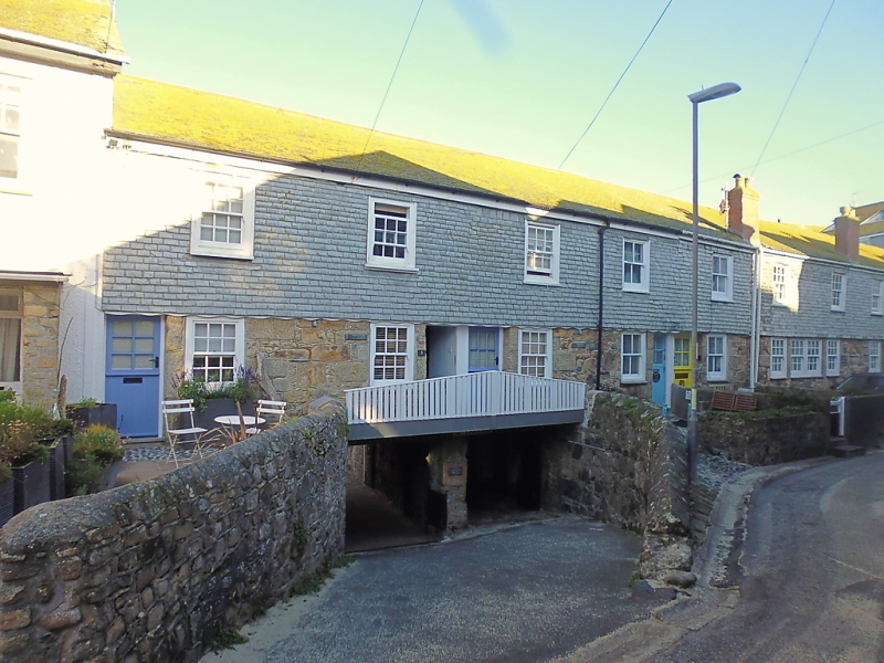
2. Originally a row of early C18 cottages with cellars below, restored. Low two storeys, twelve windows total. Ground floor uncoursed rubble, first floor slate hung. Windows double-hung sashes, with glazing bars, some early C19, some C20. Brick chimney stacks rising from front wall.
Listing NGR: SW5191240961
External links are from the relevant listing authority and, where applicable, Wikidata. Wikidata IDs may be related buildings as well as this specific building. If you want to add or update a link, you will need to do so by editing the Wikidata entry.


Other nearby listed buildings