Latitude: 51.9874 / 51°59'14"N
Longitude: -0.6183 / 0°37'5"W
OS Eastings: 494978
OS Northings: 233002
OS Grid: SP949330
Mapcode National: GBR F2D.6JB
Mapcode Global: VHFQY.79HT
Plus Code: 9C3XX9PJ+WM
Entry Name: Crowholt
Listing Date: 22 October 1952
Grade: II
Source: Historic England
Source ID: 1311747
English Heritage Legacy ID: 38212
ID on this website: 101311747
Location: Woburn, Central Bedfordshire, MK17
County: Central Bedfordshire
Civil Parish: Woburn
Built-Up Area: Woburn
Traditional County: Bedfordshire
Lieutenancy Area (Ceremonial County): Bedfordshire
Church of England Parish: Woburn
Church of England Diocese: St.Albans
Tagged with: Building
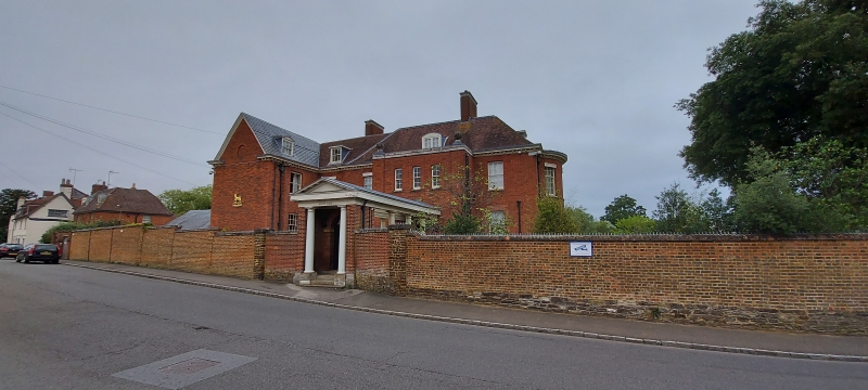
SP 9433-9533 WOBURN GEORGE STREET SP 9432-9532 (East Side) 8/109 & 9/109 Crowholt 22.10.52 GV II House. C18, reworked and extended C19 and C20. Red brick with slate roofs. Some later parts in mottled yellow brick. Main block of 2 storeys and attics with hipped roof. L-plan block of same height adjoins to LH. Main block: projecting 2-storeyed central bay has part glazed door to ground floor, 3 narrow sashes to first floor, and stone coped parapet. Flanking bays have sash windows with glazing bars, LH ones retaining wood valances. Attic has segmental-headed dormer with 2-light casement. Wood modillion cornice to eaves. Pedimented Doric portico-cum-loggia, 4 columns deep, extends from central bay to road edge. Columns on road edge flanked by brick piers. Red brick multiple ridge stack. Similar fenestration to other parts of building.
Listing NGR: SP9497833002
External links are from the relevant listing authority and, where applicable, Wikidata. Wikidata IDs may be related buildings as well as this specific building. If you want to add or update a link, you will need to do so by editing the Wikidata entry.


Other nearby listed buildings