Latitude: 53.2967 / 53°17'48"N
Longitude: -1.6342 / 1°38'3"W
OS Eastings: 424479
OS Northings: 377814
OS Grid: SK244778
Mapcode National: GBR KZ19.0X
Mapcode Global: WHCCV.WD0H
Plus Code: 9C5W79W8+M8
Entry Name: Grindleford Bridge
Listing Date: 12 July 1967
Grade: II
Source: Historic England
Source ID: 1311400
English Heritage Legacy ID: 81557
ID on this website: 101311400
Location: Grindleford, Derbyshire Dales, Derbyshire, S32
County: Derbyshire
District: Derbyshire Dales
Civil Parish: Grindleford
Built-Up Area: Grindleford
Traditional County: Derbyshire
Lieutenancy Area (Ceremonial County): Derbyshire
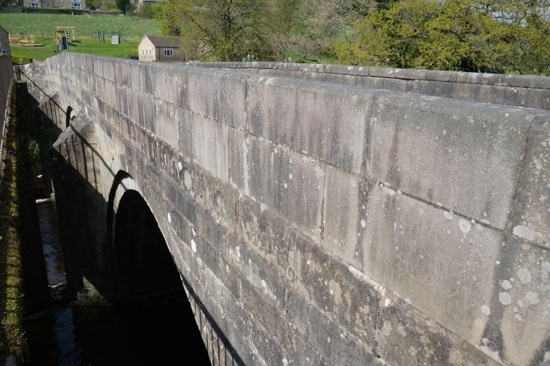
SK 27 NW PARISH OF NETHER PADLEY GRINDLEFORD 1/22 12.7.67 Grindleford Bridge GV II Road bridge. Late C17 and late C18. Triple-arched bridge of ashlar gritstone. North side; semi-circular arches with voussoirs, rounded cutwaters with domed caps and above, a broad band course. Parapet wall with rounded copings, terminating in octagonal piers. South side, with stepped arches and pointed cutwaters, and a cambered parapet. Also a Scheduled Ancient Monument. See also Eyam Woodlands parish.
Listing NGR: SK2447977814


Other nearby listed buildings