Latitude: 54.5801 / 54°34'48"N
Longitude: -1.8022 / 1°48'7"W
OS Eastings: 412883
OS Northings: 520561
OS Grid: NZ128205
Mapcode National: GBR HHVG.MY
Mapcode Global: WHC5L.942N
Plus Code: 9C6WH5JX+24
Entry Name: 5, Office Square
Listing Date: 14 September 1966
Last Amended: 30 September 1987
Grade: II
Source: Historic England
Source ID: 1310432
English Heritage Legacy ID: 111540
ID on this website: 101310432
Location: Staindrop, County Durham, DL2
County: County Durham
Civil Parish: Staindrop
Built-Up Area: Staindrop
Traditional County: Durham
Lieutenancy Area (Ceremonial County): County Durham
Church of England Parish: Staindrop
Church of England Diocese: Durham
Tagged with: Building
STAINDRUP OFFICE SQUARE NZ 1220 (South side) 17/175 No. 5 14/9/66 (Formerly listed as Nos. 4, 5 and 6)
GV II
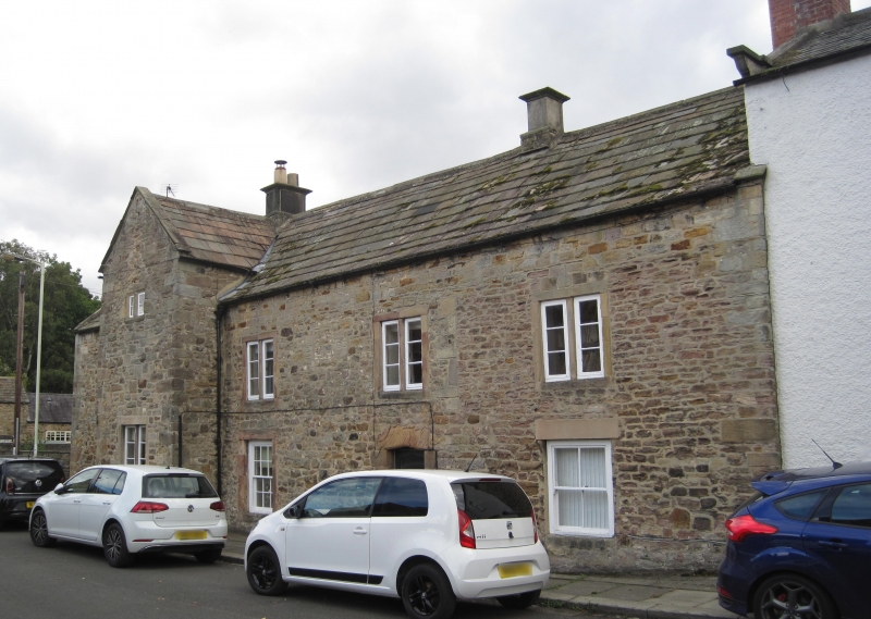
Manor house, at one time 3 separate dwellings, now united. C17. Sandstone rubble with ashlar dressings and irregular quoins; stone-flagged roof with stone gable copings and ridge. 2 storeys, 5 bays, the second projecting under gable. Partly-glazed renewed panelled door in chamfered flat-Tudor-arched surround, with block jambs, in fourth bay. Sashes with glazing bars flank door, at left in plain stone surround, at right under inserted flat stone lintel; plain stone surrounds to 2-light casements and small paired chamfered fixed lights high in gabled projection. Wide re-used lintel with hole for iron bar below this window; small blocked first-floor opening between third and fourth bays.
Quoins and change of character of rubble suggest right-first-floor bay an addition, after which eaves of 3 right bays were raised.
Interior not inspected.
Listing NGR: NZ1288520558
External links are from the relevant listing authority and, where applicable, Wikidata. Wikidata IDs may be related buildings as well as this specific building. If you want to add or update a link, you will need to do so by editing the Wikidata entry.


Other nearby listed buildings