Latitude: 53.5613 / 53°33'40"N
Longitude: -0.2983 / 0°17'53"W
OS Eastings: 512808
OS Northings: 408535
OS Grid: TA128085
Mapcode National: GBR VWC8.63
Mapcode Global: WHHHP.DR56
Plus Code: 9C5XHP62+GM
Entry Name: Boundary Farmhouse
Listing Date: 1 November 1966
Grade: II
Source: Historic England
Source ID: 1308784
English Heritage Legacy ID: 196656
ID on this website: 101308784
Location: Great Limber, West Lindsey, Lincolnshire, DN37
County: Lincolnshire
District: West Lindsey
Civil Parish: Great Limber
Built-Up Area: Great Limber
Traditional County: Lincolnshire
Lieutenancy Area (Ceremonial County): Lincolnshire
Church of England Parish: Brocklesby Park
Church of England Diocese: Lincoln
Tagged with: Farmhouse
TA 10 NW GREAT LIMBER GRASBY ROAD (North side) 5/109 Boundary Farm House 1-11-66 II
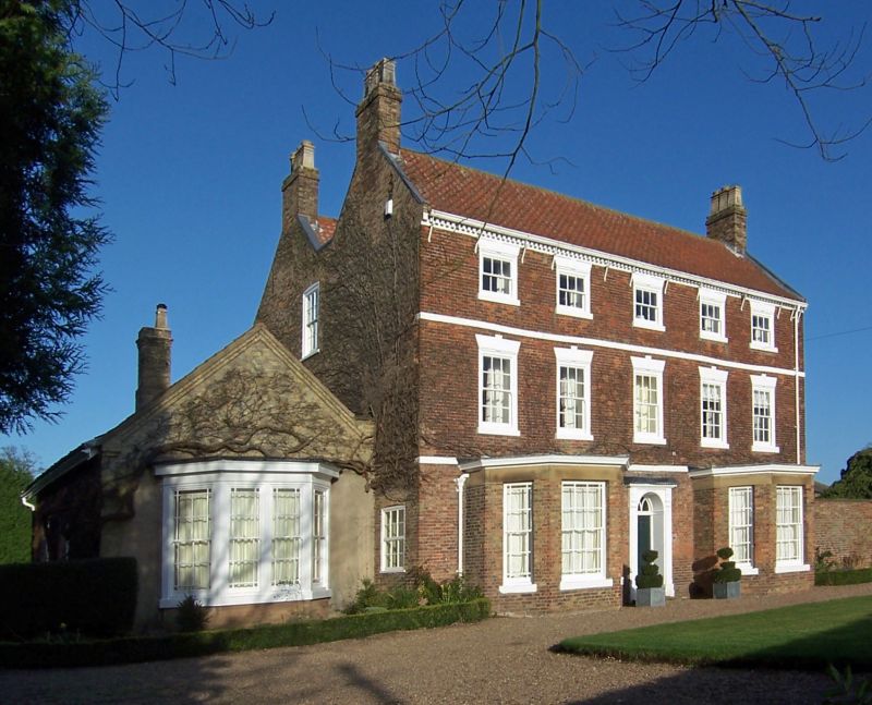
House, 1773, with C19 alterations. Brick with ashlar dressings, black glazed pantile roof, 2 brick gable stacks, brick coped and tumbled gables. 5 bay 3 storey front, first and second floor bands with dentillated eaves course. Parallel ranges. Central C19 glazed panelled door with traceried fanlight and semicircular arch flanked by pilasters supporting a narrow flat head. Flanked by single C19 canted bay windows with bordered glazing bar sashes, plain friezes and moulded cornices. On the first floor are 5 glazing bar sash windows and on the second floor 5 smaller similar windows. All upper windows have splayed lintels with raised keyblocks. To left of front is a single storey C19 billiard room extension with a 2 light glazing bar sash canted bay window. 1773 date recorded in the iron ties in the left gable; both gables tumbled. This house was built as part of a model farm complex by the first Earl of Yarborough.
Listing NGR: TA1280808535
External links are from the relevant listing authority and, where applicable, Wikidata. Wikidata IDs may be related buildings as well as this specific building. If you want to add or update a link, you will need to do so by editing the Wikidata entry.


Other nearby listed buildings