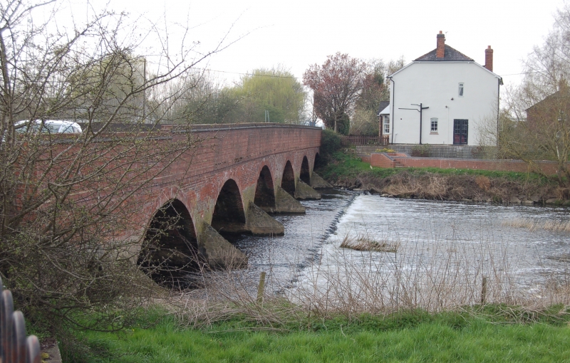
Latitude: 52.7803 / 52°46'49"N
Longitude: -1.1798 / 1°10'47"W
OS Eastings: 455417
OS Northings: 320616
OS Grid: SK554206
Mapcode National: GBR 8KN.NK1
Mapcode Global: WHDHQ.VCBX
Plus Code: 9C4WQRJC+43
Entry Name: Cotes Bridge
Listing Date: 15 March 1984
Grade: II
Source: Historic England
Source ID: 1307344
English Heritage Legacy ID: 189290
ID on this website: 101307344
Location: Cotes, Charnwood, Leicestershire, LE12
County: Leicestershire
District: Charnwood
Civil Parish: Cotes
Traditional County: Leicestershire
Lieutenancy Area (Ceremonial County): Leicestershire
Church of England Parish: Prestwold St Andrew
Church of England Diocese: Leicester
SK 52 SE COTES NOTTINGHAM ROAD
1/32 Cotes Bridge
II
Bridge over Soar, medieval and later. 1 pointed rubble stone arch to SE and
the stone cutwaters are medieval, the 6 segmental brick arches are probably
C19, and the parapet is a C20 rebuilding.
Listing NGR: SK5541720616


Other nearby listed buildings