Latitude: 51.8923 / 51°53'32"N
Longitude: 0.1944 / 0°11'39"E
OS Eastings: 551097
OS Northings: 223803
OS Grid: TL510238
Mapcode National: GBR MDL.7ZB
Mapcode Global: VHHLP.BP3Q
Plus Code: 9F32V5RV+WP
Entry Name: Forest Hall
Listing Date: 22 February 1980
Grade: II
Source: Historic England
Source ID: 1306099
English Heritage Legacy ID: 121508
ID on this website: 101306099
Location: Birchanger, Uttlesford, Essex, CM24
County: Essex
District: Uttlesford
Civil Parish: Birchanger
Built-Up Area: Stansted Mountfitchet
Traditional County: Essex
Lieutenancy Area (Ceremonial County): Essex
Church of England Parish: Birchanger St Mary the Virgin
Church of England Diocese: Chelmsford
Tagged with: House
BIRCHANGER FOREST HALL ROAD 1. 5222 Forest Hall TL 52 SW 25/94
II
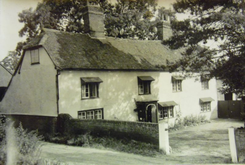
2. C18 timber-framed and plastered house standing at right angles to the road. Two storeys. On the west front there is a 4 window range of casements with glazing bars. Roof tiled, gambrel, with a catslide and a gabled dormer on the east side and 2 central chimney stacks.
Listing NGR: TL5109723803
External links are from the relevant listing authority and, where applicable, Wikidata. Wikidata IDs may be related buildings as well as this specific building. If you want to add or update a link, you will need to do so by editing the Wikidata entry.


Other nearby listed buildings