Latitude: 52.0543 / 52°3'15"N
Longitude: -1.8485 / 1°50'54"W
OS Eastings: 410484
OS Northings: 239551
OS Grid: SP104395
Mapcode National: GBR 3M1.1H7
Mapcode Global: VHB11.XM4K
Plus Code: 9C4W3532+MH
Entry Name: Pool Farmhouse
Listing Date: 20 February 1985
Grade: II
Source: Historic England
Source ID: 1305557
English Heritage Legacy ID: 127085
ID on this website: 101305557
Location: Willersey, Cotswold, Gloucestershire, WR12
County: Gloucestershire
District: Cotswold
Civil Parish: Willersey
Built-Up Area: Willersey
Traditional County: Gloucestershire
Lieutenancy Area (Ceremonial County): Gloucestershire
Church of England Parish: Willersey with Saintbury
Church of England Diocese: Gloucester
Tagged with: Farmhouse
SP 1039-1139 WILLERSEY MAIN STREET (west side)
14/169 Pool Farmhouse
II
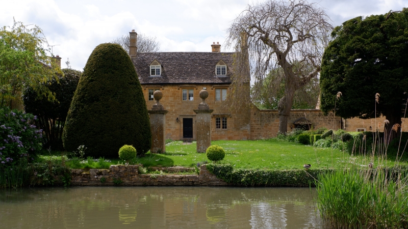
Former farmhouse, now house. C18 with C20 extension and outbuilding attached right, not of listable quality. Ashlar limestone facade. Artifical stone roof with flat gable coping and ashlar gable end stacks. Main body extended back rear right. 2 storeys and attic lit by 2 gabled dormers from roof with 2-light casements with glazing bars. 2 windowed: 2-light flat chamfered stone mullioned casements with stopped hoods, all with metal casements and glazing bars. Central 4 panel, C18 door within moulded and lugged architrave.
Listing NGR: SP1048439551
External links are from the relevant listing authority and, where applicable, Wikidata. Wikidata IDs may be related buildings as well as this specific building. If you want to add or update a link, you will need to do so by editing the Wikidata entry.


Other nearby listed buildings