Latitude: 50.7337 / 50°44'1"N
Longitude: -1.7757 / 1°46'32"W
OS Eastings: 415925
OS Northings: 92700
OS Grid: SZ159927
Mapcode National: GBR 55B.V77
Mapcode Global: FRA 7754.N16
Plus Code: 9C2WP6MF+FP
Entry Name: 1, CHURCH STREET (See details for further address information)
Listing Date: 12 February 1976
Grade: II
Source: Historic England
Source ID: 1304385
English Heritage Legacy ID: 101481
ID on this website: 101304385
Location: Christchurch, Bournemouth, Christchurch and Poole, Dorset, BH23
County: Bournemouth, Christchurch and Poole
Parish: Christchurch
Built-Up Area: Christchurch
Traditional County: Hampshire
Lieutenancy Area (Ceremonial County): Dorset
Church of England Parish: Christchurch Holy Trinity
Church of England Diocese: Winchester
Tagged with: Building
CHURCH STREET 1. (East Side) 5187 No 1 SZ 1592 1A/118
II GV
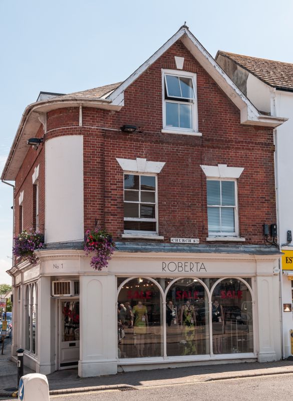
2. Mid C19. Red brick with rounded corner of painted brick at junction of Church Street and Castle Street. Wide, bracketed eaves curved round corner. Hipped slate roof with centre gable. 2 storeys and 1 attic window in gable. 2 windows, sashes with stuccoed lintels and vermiculated keystones, late C19 glazing. Ground floor has good shop front. Corner entrance with round arch and fanlight with decorated iron spandrels. 3 arched lights to window, with cast iron pillars between and panelled side pilasters. Fascia board now covers cornice. Castle Street facade has same window of 3 lights and eastern carriageway entrance with dentil cornice exposed above.
No 1 forms a group with Nos 2 to 4 (consec) and is also part of groups on Castle Street and High Street at this junction of the three main streets in the centre of Christchurch.
Listing NGR: SZ1593592702
External links are from the relevant listing authority and, where applicable, Wikidata. Wikidata IDs may be related buildings as well as this specific building. If you want to add or update a link, you will need to do so by editing the Wikidata entry.


Other nearby listed buildings