Latitude: 54.9469 / 54°56'48"N
Longitude: -1.9727 / 1°58'21"W
OS Eastings: 401845
OS Northings: 561358
OS Grid: NZ018613
Mapcode National: GBR GCN7.QG
Mapcode Global: WHB2F.NXTJ
Plus Code: 9C6WW2WG+QW
Entry Name: Footbridge Across Riding Mill Burn 40 Metres North of St. James' Church*
Listing Date: 18 June 1986
Grade: II
Source: Historic England
Source ID: 1303834
English Heritage Legacy ID: 240436
ID on this website: 101303834
Location: Riding Mill, Northumberland, NE44
County: Northumberland
Civil Parish: Broomhaugh and Riding
Built-Up Area: Riding Mill
Traditional County: Northumberland
Lieutenancy Area (Ceremonial County): Northumberland
Church of England Parish: St James, Riding Mill
Church of England Diocese: Newcastle
Tagged with: Footbridge
BROOMHAUGH AND RIDING BROOMHAUGH/RIDING MILL NZ 0161 22/69 Footbridge across Riding Mill Burn 40 metres north of St. James' Church
GV II
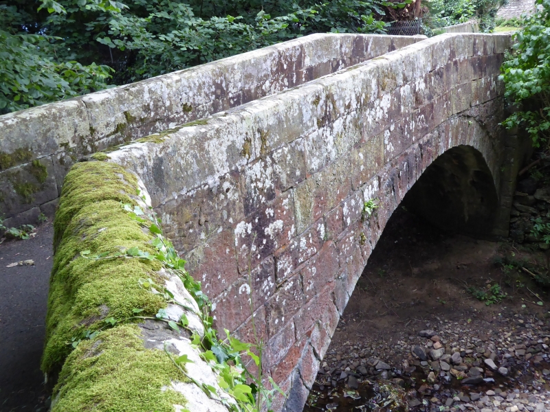
Packhorse Bridge, probably C17 but incorporating earlier fabric. Roughly squared stone with tooled stone parapet. Single segmental arch, chamfered parapet of large blocks clamped together. The more widely splayed south abutment has a drain with a stone spout on the west. Known locally as the 'Roman Bridge', and sited on the line of Dere Street. The arch and north abutment may be C17 (1603 : OS record card) with parapet rebuilt in C18 or C19, but the south abutment incorporates at least 2 phases of medieval or earlier masonry.
Listing NGR: NZ0184561358
External links are from the relevant listing authority and, where applicable, Wikidata. Wikidata IDs may be related buildings as well as this specific building. If you want to add or update a link, you will need to do so by editing the Wikidata entry.


Other nearby listed buildings