Latitude: 51.6939 / 51°41'38"N
Longitude: -1.6936 / 1°41'36"W
OS Eastings: 421276
OS Northings: 199506
OS Grid: SU212995
Mapcode National: GBR 4ST.QNQ
Mapcode Global: VHC0B.LPJ9
Plus Code: 9C3WM8V4+HH
Entry Name: Tottifey
Listing Date: 4 July 1985
Grade: II
Source: Historic England
Source ID: 1303151
English Heritage Legacy ID: 129018
ID on this website: 101303151
Location: Lechlade-on-Thames, Cotswold, Gloucestershire, GL7
County: Gloucestershire
District: Cotswold
Civil Parish: Lechlade
Built-Up Area: Lechlade-on-Thames
Traditional County: Gloucestershire
Lieutenancy Area (Ceremonial County): Gloucestershire
Church of England Parish: Lechlade St Lawrence
Church of England Diocese: Gloucester
Tagged with: Building
SU 2199 LECHLADE HIGH STREET (south side)
10/173 Tottifey
GV II
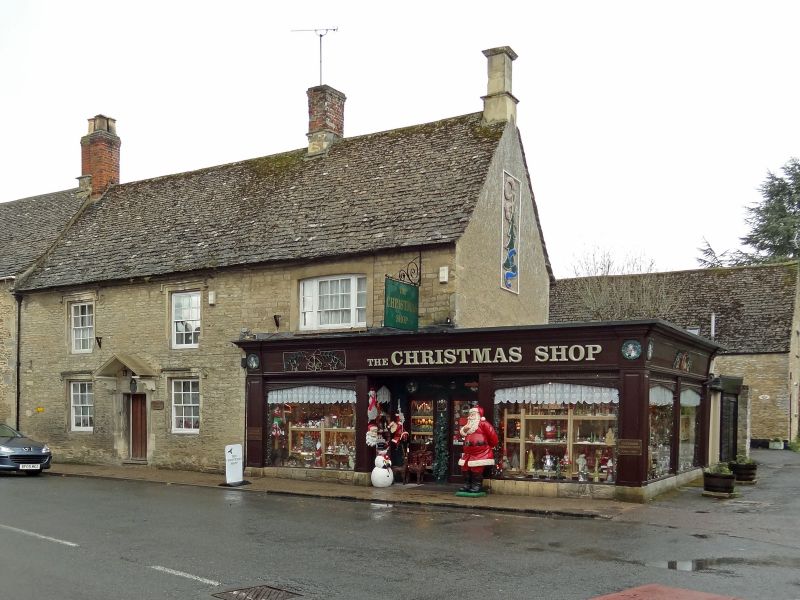
Formerly 2 adjoining houses on end of small terrace, with ground floor shop front to corner house, converted to one property. House to left probably late C17, with end house added in late C18 or early C19. Coursed rubble stone, steep stone slate roof, end stacks to earlier house - brick to left, stone base with brick flue to right - and stone end stack to additional house. Single range of 2 storeys, with rear extension to main house in roughcast with slate roof. Main range has 2 windows, former 2-Light stone mullions with square hoodmould, with mullions removed and sills lowered to form 12-pane sashes. Two similar below, central doorcase with open stone pediment on consoles, chamfered lintel and quoins and C20 timber door. Addition to right has truncated triple sash on first floor in flush stone cambered arch, with late C20 shop front in timber below, replacing a garage anti projecting at single storey level to east.
Listing NGR: SU2127699506
External links are from the relevant listing authority and, where applicable, Wikidata. Wikidata IDs may be related buildings as well as this specific building. If you want to add or update a link, you will need to do so by editing the Wikidata entry.


Other nearby listed buildings