Latitude: 53.1992 / 53°11'57"N
Longitude: -1.0232 / 1°1'23"W
OS Eastings: 465351
OS Northings: 367351
OS Grid: SK653673
Mapcode National: GBR 9G5.D4N
Mapcode Global: WHFGT.8V18
Plus Code: 9C5W5XXG+MP
Entry Name: Old Post Office
Listing Date: 11 August 1961
Last Amended: 28 April 1986
Grade: II
Source: Historic England
Source ID: 1302573
English Heritage Legacy ID: 241915
ID on this website: 101302573
Location: Ollerton, Newark and Sherwood, Nottinghamshire, NG22
County: Nottinghamshire
District: Newark and Sherwood
Civil Parish: Ollerton and Boughton
Built-Up Area: New Ollerton
Traditional County: Nottinghamshire
Lieutenancy Area (Ceremonial County): Nottinghamshire
Church of England Parish: Ollerton with Boughton
Church of England Diocese: Southwell and Nottingham
Tagged with: Post office
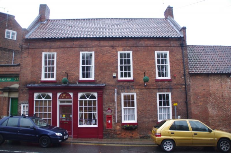
OLLERTON MARKET PLACE SK 66 NE (south west side) 3/65 Old Post Office (formerly listed as Post 11.8.61 Office and House)
G.V. II
House. Early C18. Used as Post Office from early C19. Brick with C20 pantile roof. First floor band, coped gables with kneelers, 2 gable stacks, that to west projecting. 2 storeys plus garrets, 4 bays. Windows are glazing bar sashes with rubbed brick heads. Front has to left, tiny sash and to its right, early C19 shop front with central half glazed door with overlight and blank fanlight, flanked by single large sashes with elliptical fanlight heads. 4 timber pilasters and dentillated cornice. To right, 2 sashes. Above, 4 sashes. East gable has mullioned casement to garret.
Listing NGR: SK6535167351
External links are from the relevant listing authority and, where applicable, Wikidata. Wikidata IDs may be related buildings as well as this specific building. If you want to add or update a link, you will need to do so by editing the Wikidata entry.


Other nearby listed buildings