Latitude: 54.2213 / 54°13'16"N
Longitude: -1.6553 / 1°39'18"W
OS Eastings: 422575
OS Northings: 480675
OS Grid: SE225806
Mapcode National: GBR JMWM.FJ
Mapcode Global: WHC7D.K506
Plus Code: 9C6W68CV+GV
Entry Name: Stanhope
Listing Date: 9 August 1966
Last Amended: 28 April 1986
Grade: II
Source: Historic England
Source ID: 1301116
English Heritage Legacy ID: 325038
ID on this website: 101301116
Location: Masham, North Yorkshire, HG4
County: North Yorkshire
District: Harrogate
Civil Parish: Masham
Built-Up Area: Masham
Traditional County: Yorkshire
Lieutenancy Area (Ceremonial County): North Yorkshire
Tagged with: Building
SE 2280-2380 MASHAM MARKET PLACE (south side)
7/48 Stanhope (formerly listed as 9.8.66 Stone House)
GV II
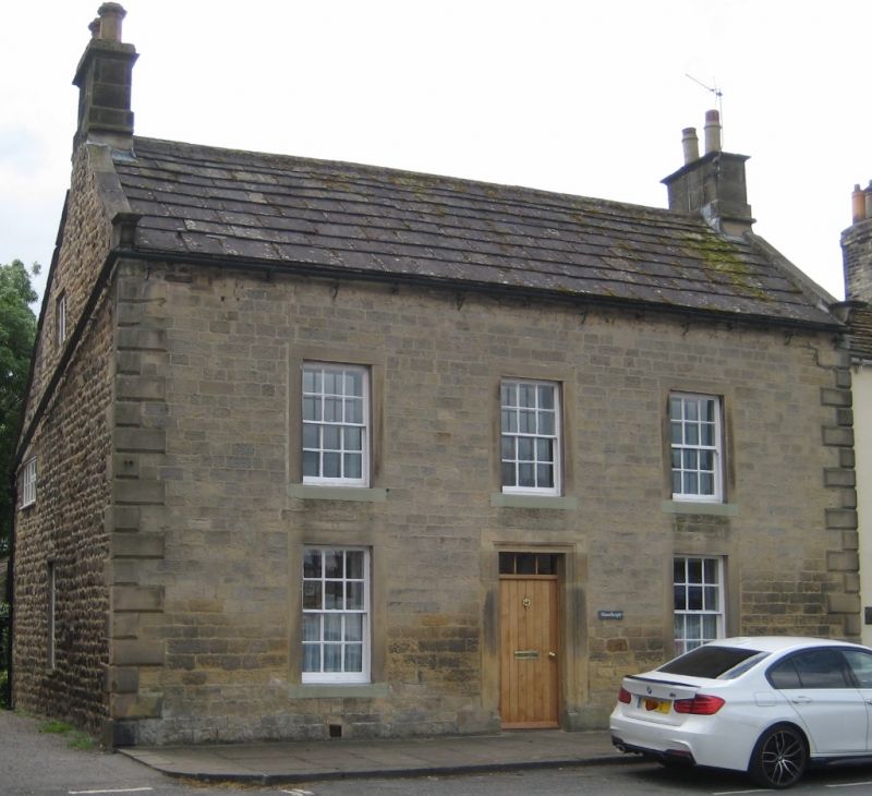
House. Late C18 - early C19. Coursed squared stone and ashlar with graduated stone slate roof. 3 bays, 2 storeys. Chamfered quoins. Central board door with 3-pane overlight set in moulded stone surround. All windows are sashes with glazing bars with plain surrounds and sills. Shaped kneelers, ashlar stone coping and end stacks.
Listing NGR: SE2257580675
External links are from the relevant listing authority and, where applicable, Wikidata. Wikidata IDs may be related buildings as well as this specific building. If you want to add or update a link, you will need to do so by editing the Wikidata entry.


Other nearby listed buildings