Latitude: 51.4323 / 51°25'56"N
Longitude: -1.5402 / 1°32'24"W
OS Eastings: 432063
OS Northings: 170463
OS Grid: SU320704
Mapcode National: GBR 6ZZ.1FZ
Mapcode Global: VHC1S.884C
Plus Code: 9C3WCFJ5+WW
Entry Name: 54, A419
Listing Date: 22 August 1966
Grade: II
Source: Historic England
Source ID: 1300659
English Heritage Legacy ID: 310577
ID on this website: 101300659
Location: Chilton Foliat, Wiltshire, RG17
County: Wiltshire
Civil Parish: Chilton Foliat
Built-Up Area: Chilton Foliat
Traditional County: Wiltshire
Lieutenancy Area (Ceremonial County): Wiltshire
Tagged with: Building Thatched cottage
SU 37 SW CHILTON FOLIAT A.419 (north side)
5/117 No 54
22.8.66
GV II
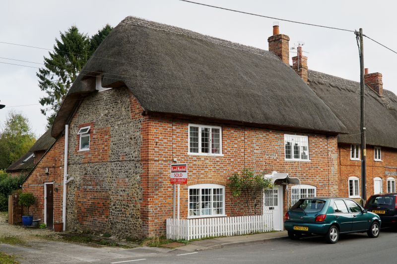
House, late C18. Diaper brick with flint side walls. Thatched roof. 2-storey, 2 bays, the right being the earlier 1-storey raised when left bay added. Entrance left of earlier bay; wide half glazed door under zinc ogee and wire lattice porch. 3-light iron paned windows with segmental heads. 3-light timber windows to first floor. Thatch hipped left, stack right. Thatched rear link to No 53 (q.v.).
Listing NGR: SU3205570515
External links are from the relevant listing authority and, where applicable, Wikidata. Wikidata IDs may be related buildings as well as this specific building. If you want to add or update a link, you will need to do so by editing the Wikidata entry.


Other nearby listed buildings