Latitude: 51.4714 / 51°28'16"N
Longitude: -1.5875 / 1°35'14"W
OS Eastings: 428749
OS Northings: 174790
OS Grid: SU287747
Mapcode National: GBR 5Y0.MGX
Mapcode Global: VHC1K.F8MX
Plus Code: 9C3WFCC7+G2
Entry Name: Baydon Manor
Listing Date: 6 March 1985
Grade: II
Source: Historic England
Source ID: 1300405
English Heritage Legacy ID: 310674
ID on this website: 101300405
Location: Marridge Hill, Wiltshire, SN8
County: Wiltshire
Civil Parish: Ramsbury
Traditional County: Wiltshire
Lieutenancy Area (Ceremonial County): Wiltshire
Tagged with: Manor house
SU 27 SE RAMSBURY MARRIDGE HILL
4/216 Baydon Manor
II
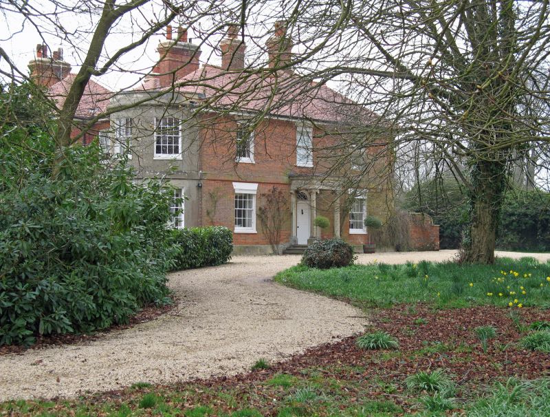
Large house, early C19 with late C19 additions and work of 1905-6. Brick, part rendered, tile and slate roofs. 2-storey. Elevation to road of 3 bays, symmetrical with central 6-panel door within delicate stone Corinthian portico. 16-pane sashes with wedge stone lintels. Left return has 2-storey renderd bow with three 16-pane sashes to each floor. Rear block with later C19 tripartite windows, stone mullions and fanlight to upper centre light. 2-bay extension to left of this elevation. Rear 3-storey water tower with pyramidal roof over entrance with glazed door and to right, part timber framed section of 1905-6 for A. E. White. A house stood on this site in 1773, and was formerly known as Marridge Hill House.
Listing NGR: SU2874974790
External links are from the relevant listing authority and, where applicable, Wikidata. Wikidata IDs may be related buildings as well as this specific building. If you want to add or update a link, you will need to do so by editing the Wikidata entry.


Other nearby listed buildings