Latitude: 52.2828 / 52°16'58"N
Longitude: -1.5835 / 1°35'0"W
OS Eastings: 428506
OS Northings: 265047
OS Grid: SP285650
Mapcode National: GBR 5M4.VWJ
Mapcode Global: VHBXH.HWPC
Plus Code: 9C4W7CM8+4H
Entry Name: 27 29, Smith Street
Listing Date: 10 January 1953
Grade: II
Source: Historic England
Source ID: 1299746
English Heritage Legacy ID: 307650
ID on this website: 101299746
Location: Warwick, Warwickshire, CV34
County: Warwickshire
District: Warwick
Civil Parish: Warwick
Built-Up Area: Warwick
Traditional County: Warwickshire
Lieutenancy Area (Ceremonial County): Warwickshire
Church of England Parish: Warwick St Nicholas
Church of England Diocese: Coventry
Tagged with: Building
1. 1781 SMITH STREET (North Side) Nos 27 and 29 SP 2865 SE 4/238 10.1.53.
II GV
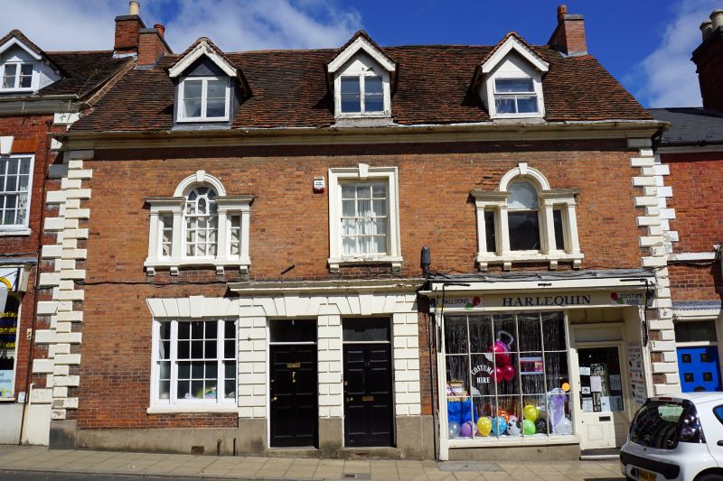
2. One building circa 1750. 2 storey plus attic, 3 window brick facade with painted stone dressings. On first floor central sash has moulded stone architrave with plain keyblock arid bracketed sill. To each side of this are identical small Venetian windows with stone pilasters and entablature complete, but one to right hand side is without glazing bars. Two identical entrances in centre with 6-fielded-panelled doors, oblong fanlights, rusticated surrounds and keyblocks. No 27 (on left hand side) has fixed plate glass light in original opening. Shopfront of No 29 (on right hand side) has vertical glazing bars only and is probably of early C19 origin. Three gabled dormers. Old tiles. Chamfered quoins. Slim pilasters, frieze and cornice to shop. VCH, viii, p.443.
Nos 23 to 29 (odd) form a group
Listing NGR: SP2850665047
External links are from the relevant listing authority and, where applicable, Wikidata. Wikidata IDs may be related buildings as well as this specific building. If you want to add or update a link, you will need to do so by editing the Wikidata entry.


Other nearby listed buildings