Latitude: 51.209 / 51°12'32"N
Longitude: 0.7953 / 0°47'43"E
OS Eastings: 595348
OS Northings: 149251
OS Grid: TQ953492
Mapcode National: GBR RW0.3X5
Mapcode Global: VHKK6.QWT0
Plus Code: 9F326Q5W+J4
Entry Name: The Moat House
Listing Date: 10 October 1980
Grade: II
Source: Historic England
Source ID: 1299658
English Heritage Legacy ID: 180687
ID on this website: 101299658
Location: Charing, Ashford, Kent, TN27
County: Kent
District: Ashford
Civil Parish: Charing
Built-Up Area: Charing
Traditional County: Kent
Lieutenancy Area (Ceremonial County): Kent
Tagged with: House
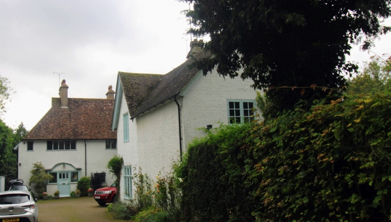
1. 5272 CHARING ASHFORD ROAD The Moat House (Nos 1 to 5 (consec)) TQ 9549 22/48 II 2. Formerly the rectory. Now divided into flats. A large late C19 to early C20 house (not of special architectural interest) incorporating on the east side (Nos 2 and 3) a C15 Wealden hall-house. This is of 2 storeys timber-framed, with close-studding and moulded bressumer to No 2. Both have coved recess and brackets. Hipped tiled roof. No 3 has a tie beam and crown post in the attics. No 2 has a recess said to be a priest hole and a passage thought to connect to Charing Parish Church. The moat survives.
Listing NGR: TQ9534849251
External links are from the relevant listing authority and, where applicable, Wikidata. Wikidata IDs may be related buildings as well as this specific building. If you want to add or update a link, you will need to do so by editing the Wikidata entry.


Other nearby listed buildings