Latitude: 51.217 / 51°13'1"N
Longitude: 0.8022 / 0°48'8"E
OS Eastings: 595797
OS Northings: 150156
OS Grid: TQ957501
Mapcode National: GBR RVT.RLY
Mapcode Global: VHKK6.VNGW
Plus Code: 9F326R82+RV
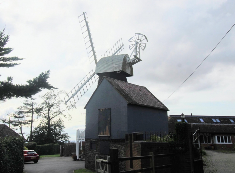
Entry Name: Charing Windmill
Listing Date: 14 February 1967
Grade: II
Source: Historic England
Source ID: 1299636
English Heritage Legacy ID: 180700
ID on this website: 101299636
Location: Charing Hill, Ashford, Kent, TN27
County: Kent
District: Ashford
Civil Parish: Charing
Built-Up Area: Charing
Traditional County: Kent
Lieutenancy Area (Ceremonial County): Kent
Tagged with: Windmill
1. 5272 CHARING BOWL ROAD Charing Hill Charing Windmill TQ 95 SE 8/58 14.2.67 II 2. Early C19 smock mill faced with weatherboarding. Octagonal red brick "round-house" with wooden platform above it. Boat-shaped cap. The sweeps were removed in 1917. The fantail is also missing. The mill was last worked in 1892. The machinery was later removed, and the main floor converted into a studio.
Listing NGR: TQ9579750156
External links are from the relevant listing authority and, where applicable, Wikidata. Wikidata IDs may be related buildings as well as this specific building. If you want to add or update a link, you will need to do so by editing the Wikidata entry.


Other nearby listed buildings