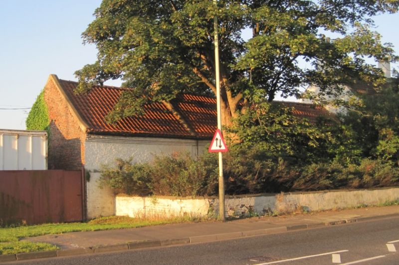
Latitude: 54.542 / 54°32'31"N
Longitude: -1.5083 / 1°30'29"W
OS Eastings: 431907
OS Northings: 516416
OS Grid: NZ319164
Mapcode National: GBR KHXX.7L
Mapcode Global: WHC5X.S3YC
Plus Code: 9C6WGFRR+RM
Entry Name: Farmbuildings on Left of Great Burdon Farmhouse
Listing Date: 27 January 1988
Grade: II
Source: Historic England
Source ID: 1299446
English Heritage Legacy ID: 350397
ID on this website: 101299446
Location: Great Burdon, Darlington, County Durham, DL1
County: Darlington
Civil Parish: Great Burdon
Built-Up Area: Darlington
Traditional County: Durham
Lieutenancy Area (Ceremonial County): County Durham
Church of England Parish: Haughton-le-Skerne
Church of England Diocese: Durham
Tagged with: Agricultural structure
GREAT BURDON THE GREEN NZ 31 NW (South side)
5/35 Farmbuildings on left of Great Burdon Farmhouse
GV II
Farmbuildings, formerly byres/loose-boxes with lofts, now storage. Mid-late C18 with alterations. Painted brick with some rubble infill; renewed pantiled roof. Long and low continuous range of 3 builds. Blocked door and window openings. Stepped eaves courses. Steeply-pitched roof with swept eaves is divided into 3 sections by copings. Rear shows altered openings and raised eaves; off-centre L-plan stone stairway to deeply-set boarded door. Included for group value.
Listing NGR: NZ3189616410
External links are from the relevant listing authority and, where applicable, Wikidata. Wikidata IDs may be related buildings as well as this specific building. If you want to add or update a link, you will need to do so by editing the Wikidata entry.


Other nearby listed buildings