Latitude: 51.3189 / 51°19'7"N
Longitude: 0.8945 / 0°53'40"E
OS Eastings: 601796
OS Northings: 161729
OS Grid: TR017617
Mapcode National: GBR SW3.BYY
Mapcode Global: VHKJW.G38S
Plus Code: 9F328V9V+GR
Entry Name: 34, Abbey Street
Listing Date: 29 July 1950
Grade: II
Source: Historic England
Source ID: 1299330
English Heritage Legacy ID: 175836
ID on this website: 101299330
Location: Faversham, Swale, Kent, ME13
County: Kent
District: Swale
Civil Parish: Faversham
Built-Up Area: Faversham
Traditional County: Kent
Lieutenancy Area (Ceremonial County): Kent
Tagged with: Building
This list entry was subject to a Minor Amendment on 30 September 2025 to correct a typo in the description and to reformat the text to current standards
TR 0161 NE
1/85
ABBEY STREET (West Side)
No 34
29.7.50.
GV
II
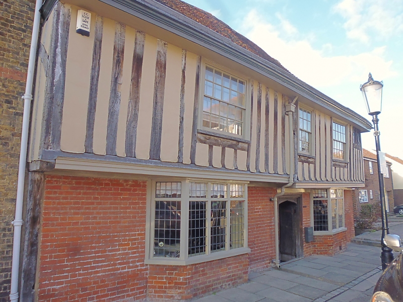
Timber-framed building, formerly the Globe inn built in 1514. Refronted in the Cl8 but retaining the overhang of its 1st floor on a bressummer. Two storeys. Three windows and one original opening at North end on first floor. Ground floor painted brick with corner post exposed at the South end. First floor plastered. Moulded wooden eaves cornice. Tiled roof. Glazing bars intact on the first floor. Two bays below with modern windows. Original doorway between them with depressed arch, small shields in the spandrels and wide ribbed door. Some original features within. Photograph NMR.
Listing NGR: TR0179461730
External links are from the relevant listing authority and, where applicable, Wikidata. Wikidata IDs may be related buildings as well as this specific building. If you want to add or update a link, you will need to do so by editing the Wikidata entry.


Other nearby listed buildings