Latitude: 51.7418 / 51°44'30"N
Longitude: -2.4784 / 2°28'42"W
OS Eastings: 367061
OS Northings: 204900
OS Grid: SO670049
Mapcode National: GBR JW.1H83
Mapcode Global: VH87C.0H32
Plus Code: 9C3VPGRC+PJ
Entry Name: Purton Viaduct
Listing Date: 2 November 1979
Last Amended: 25 January 1985
Grade: II
Source: Historic England
Source ID: 1299210
English Heritage Legacy ID: 353942
ID on this website: 101299210
Location: Purton, Forest of Dean, Gloucestershire, GL15
County: Gloucestershire
District: Forest of Dean
Civil Parish: Awre
Traditional County: Gloucestershire
Lieutenancy Area (Ceremonial County): Gloucestershire
Church of England Parish: Blakeney All Saints
Church of England Diocese: Gloucester
Tagged with: Viaduct Railway viaduct
SO 60 NE AWRE PURTON
3/159 Purton Viaduct (formerly listed as Railway 2.11.79 Viaduct over Etloe to Purton Road) - II
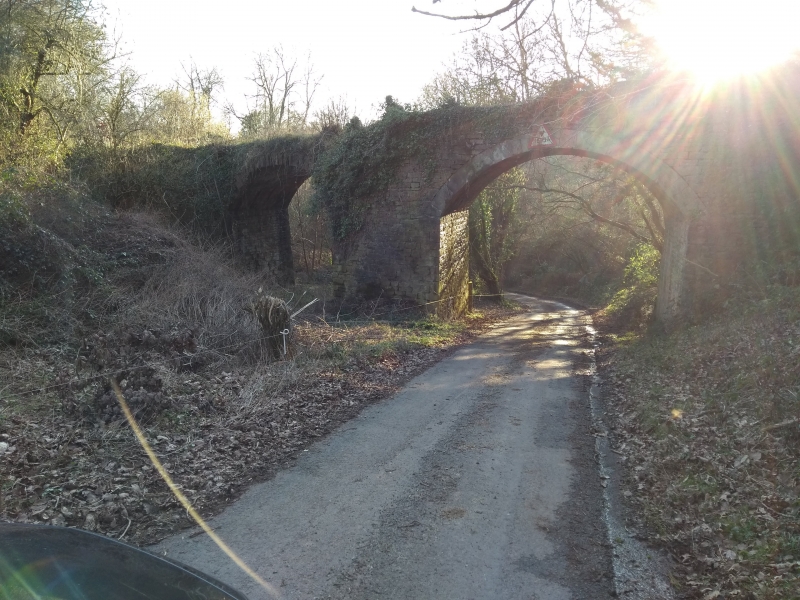
Railway viaduct. c.1832. For the Purton Steam Carriage Hoad, crossing the Etloe-Purton road. Red sandstone rubble with dressed voussoirs. 3 arches of diminishing heights, main pier wedge shaped, so that the viaduct is slightly angled: the tallest arch spans road; centre one damaged on NE side. South east wall continues as retaining wall for some distance, slightly curved return to NE. Part of the parapet survives at the north west end. This viaduct is of considerable historical and industrial archaeological interest: the Purton Steam Carriage Road was planned in 1830 - ie at the same time as the Stockton and Darlington Railway first ran. It never in fact ran, but had considerable effect on local politics at the time, and on later railway enterprises in the area. The finance was to come from a prominent local Iron-master, Charles Mathias of Lamphey Court, Pembrokeshire. The viaduct is the most tan- gible surviving evidence for an industrial scheme which would have involved the first crossing of the Severn on a moveable bridge.
Listing NGR: SO6706104900
External links are from the relevant listing authority and, where applicable, Wikidata. Wikidata IDs may be related buildings as well as this specific building. If you want to add or update a link, you will need to do so by editing the Wikidata entry.


Other nearby listed buildings