Latitude: 51.7183 / 51°43'5"N
Longitude: -1.9702 / 1°58'12"W
OS Eastings: 402153
OS Northings: 202172
OS Grid: SP021021
Mapcode National: GBR 3QY.6Q3
Mapcode Global: VHB2Q.S2SL
Plus Code: 9C3WP29H+8W
Entry Name: Abbot's
Listing Date: 14 June 1948
Last Amended: 24 May 1993
Grade: II
Source: Historic England
Source ID: 1298700
English Heritage Legacy ID: 365220
ID on this website: 101298700
Location: Cirencester, Cotswold, Gloucestershire, GL7
County: Gloucestershire
District: Cotswold
Civil Parish: Cirencester
Built-Up Area: Cirencester
Traditional County: Gloucestershire
Lieutenancy Area (Ceremonial County): Gloucestershire
Church of England Parish: Cirencester St John the Baptist
Church of England Diocese: Gloucester
Tagged with: Building
CIRENCESTER
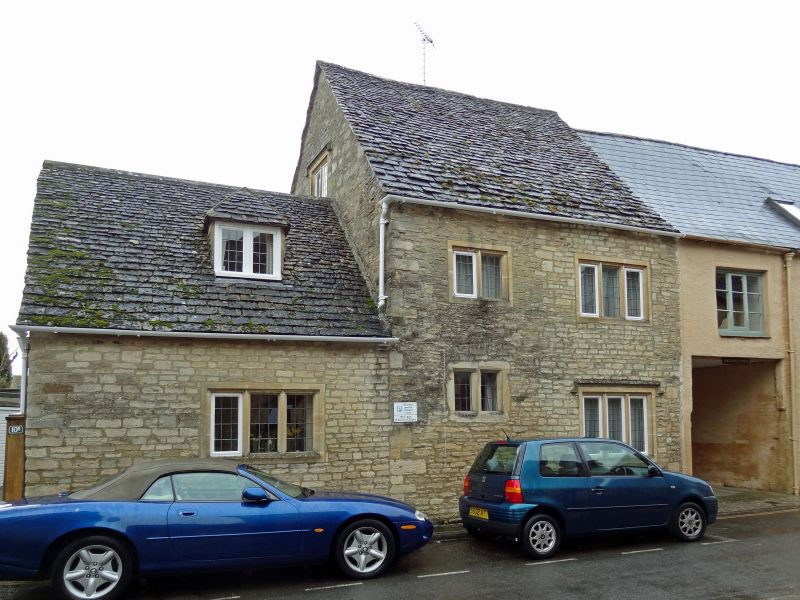
SP0202 COXWELL STREET 578-1/4/79 (North side) 14/06/48 Nos.10 AND 10B Abbot's (10B) (Formerly Listed as: COXWELL STREET (North side) No.10)
GV II
House, now 2. Dated 1640, much altered C19 and C20. Coursed limestone rubble with cement render to right (No.10); Welsh slate roof to right (No.10), stone slate roof to left (No.10B); stacks on gable ends to rear, brick to right (No.10), stone to left (No.10B). House has carriage entrance through centre. 2-storey 5-window range with single-storey and attic 1-window extension to left. One C20 three-light ovolo-moulded stone-mullion window with leaded lights to left with similar 2-light window to extreme left; 3 timber casement and top-hung windows with glazing bars to right (No.10). Ground floor has one C20 three-light ovolo-moulded stone-mullion window with leaded lights under hoodmould to left with one C17 two-light chamfered stone-mullion window with leaded lights to extreme left; one 3-light timber casement to right with concrete cill. Large C17 round-headed doorcase with band of bold rustication and bold keystone under dripstone supported on brackets; moulded plinth on block above dripstone over bracket to right, initials I P and date 1640 under brackets to left and right. C17 boarded and framed round-headed 6-panel door with simple pattern of studs in top 2 panels and is repaired at bottom. INTERIOR not inspected. Initials and date refer to lawyer, John Plot, whose house was pillaged by Royalist soldiers in Civil War. (The Buildings of England: Verey D: Gloucestershire: The Cotswolds: London: 1970-: P 176).
Listing NGR: SP0215302172
External links are from the relevant listing authority and, where applicable, Wikidata. Wikidata IDs may be related buildings as well as this specific building. If you want to add or update a link, you will need to do so by editing the Wikidata entry.


Other nearby listed buildings