Latitude: 51.7208 / 51°43'14"N
Longitude: -1.9719 / 1°58'18"W
OS Eastings: 402036
OS Northings: 202450
OS Grid: SP020024
Mapcode National: GBR 3QY.095
Mapcode Global: VHB2Q.R0WP
Plus Code: 9C3WP2CH+86
Entry Name: 65, Gloucester Street
Listing Date: 23 July 1971
Grade: II
Source: Historic England
Source ID: 1298677
English Heritage Legacy ID: 365312
ID on this website: 101298677
Location: Cirencester, Cotswold, Gloucestershire, GL7
County: Gloucestershire
District: Cotswold
Civil Parish: Cirencester
Built-Up Area: Cirencester
Traditional County: Gloucestershire
Lieutenancy Area (Ceremonial County): Gloucestershire
Church of England Parish: Cirencester St John the Baptist
Church of England Diocese: Gloucester
Tagged with: Building
CIRENCESTER
SP0202 GLOUCESTER STREET 578-1/4/175 (South West side) 23/07/71 No.65
GV II
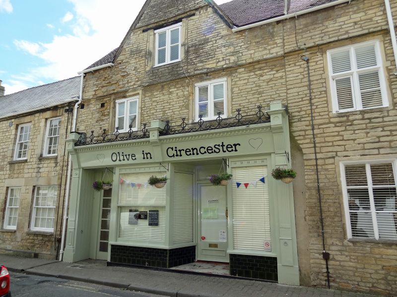
House, now shop with flat over. Late C17 with later alterations, further external and internal alterations in progress 1990. Coursed squared limestone; concrete tile roof; no stack visible. One gable to front. 2 storeys and attic; 2-window range. Two C20 2-light timber casements in stone surrounds with mullions and transoms cut out; similar window in gable above with inserted timber lintel. Late C19 timber shopfront with moulded pilasters to each side, moulded cornice and ironwork cresting. Door to left gives access to through passage to rear. Moulded string over first floor and in gable. INTERIOR largely altered C20; enclosed winder staircase from first to second floor front.
Listing NGR: SP0203602450
External links are from the relevant listing authority and, where applicable, Wikidata. Wikidata IDs may be related buildings as well as this specific building. If you want to add or update a link, you will need to do so by editing the Wikidata entry.


Other nearby listed buildings