Latitude: 54.0494 / 54°2'57"N
Longitude: -2.8061 / 2°48'22"W
OS Eastings: 347318
OS Northings: 461797
OS Grid: SD473617
Mapcode National: GBR 8PVM.84
Mapcode Global: WH846.VGYZ
Plus Code: 9C6V25XV+QH
Entry Name: Piers and Low Wall Around Castle Precinct to South of Castle
Listing Date: 13 March 1995
Grade: II
Source: Historic England
Source ID: 1298406
English Heritage Legacy ID: 383091
ID on this website: 101298406
Location: Lancaster, Lancashire, LA1
County: Lancashire
District: Lancaster
Electoral Ward/Division: Castle
Parish: Non Civil Parish
Built-Up Area: Lancaster
Traditional County: Lancashire
Lieutenancy Area (Ceremonial County): Lancashire
Church of England Parish: Lancaster St Mary with St John and St Anne
Church of England Diocese: Blackburn
LANCASTER
SD4761NW CASTLE PARK 1685-1/6/60 (North side) Piers and low wall around Castle precinct to south of Castle
GV II
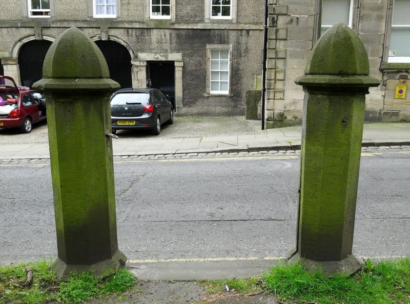
Set of 12 piers and a dwarf wall, originally supporting railings. Early C19. Sandstone ashlar. Octagonal in plan, with a faceted pointed cap above a pronounced string course. Near the centre of the south side a pair of piers originally flanked an iron gate. HISTORY: placed to demarcate the boundary of the Castle Park which was laid out on and near the castle ditch. Not marked on Binns' map of 1821, but clearly shown on the 5 feet to the mile Ordnance Survey map surveyed in 1845. (Ordnance Survey: Map of Lancaster at Five Feet to One Mile: Southampton: 1849-).
Listing NGR: SD4731761798
External links are from the relevant listing authority and, where applicable, Wikidata. Wikidata IDs may be related buildings as well as this specific building. If you want to add or update a link, you will need to do so by editing the Wikidata entry.


Other nearby listed buildings