Latitude: 54.051 / 54°3'3"N
Longitude: -2.8007 / 2°48'2"W
OS Eastings: 347674
OS Northings: 461966
OS Grid: SD476619
Mapcode National: GBR 8PWL.GL
Mapcode Global: WH846.YFHS
Plus Code: 9C6V352X+9P
Entry Name: 9 and 11, Cable Street
Listing Date: 22 December 1953
Grade: II
Source: Historic England
Source ID: 1298384
English Heritage Legacy ID: 383061
ID on this website: 101298384
Location: Lancaster, Lancashire, LA1
County: Lancashire
District: Lancaster
Electoral Ward/Division: Bulk
Parish: Non Civil Parish
Built-Up Area: Lancaster
Traditional County: Lancashire
Lieutenancy Area (Ceremonial County): Lancashire
Church of England Parish: Lancaster Christ Church
Church of England Diocese: Blackburn
Tagged with: Building
LANCASTER
SD4761NE CABLE STREET 1685-1/7/27 (North side) 22/12/53 Nos.9 AND 11
GV II
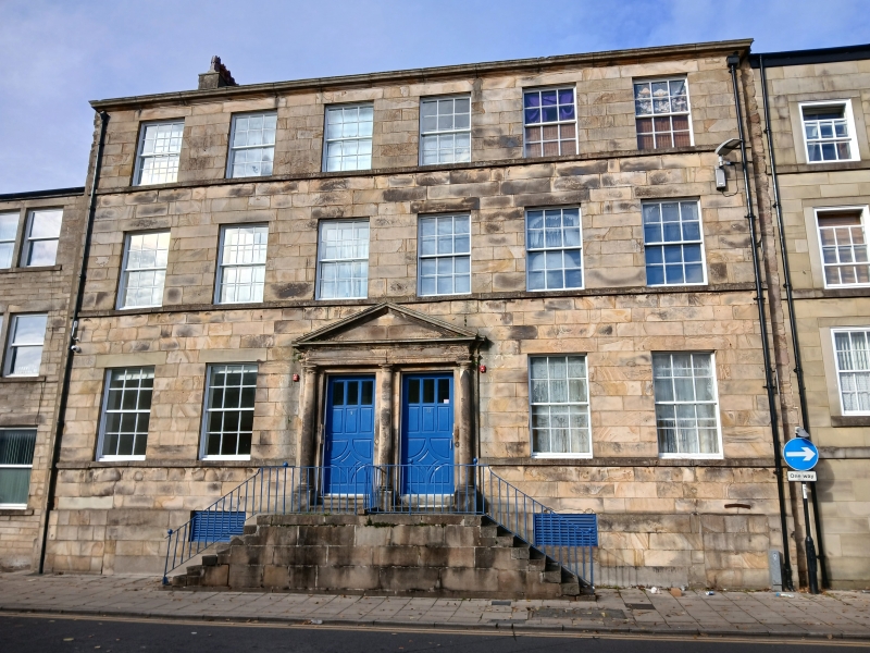
Pair of houses, now flats. Late C18, altered c1985. Sandstone ashlar facade with ashlar dressings, and coursed sandstone rubble elsewhere. Slate roof, with gable chimney to the left. Double-depth plan, with a centrally-placed double doorway and, originally, with a centrally-placed pair of rear wings. 3 storeys over a tall basement and 3 bays per house, with a sill band on each floor and a moulded eaves cornice. The former basement windows are blocked; all the others have plain reveals, some with renewed lintels, and contain recently inserted 12-pane sashes, of diminishing height in successive storeys. The doorway is raised and approached up a double flight of 8 nosed steps, parallel to the facade and protected by renewed iron railings. It has a pediment with a pulvinated frieze carried on 3 engaged Tuscan columns. The doors are panelled, each with 3 glazed panels above 3 that are raised and fielded and with the lower part panelled in a curved pattern. INTERIOR: entrance hall arch with fluted pilasters and moulded plaster urns and swags over the arch, and a dogleg staircase with an open string, scrolled brackets and recent turned balusters and ramped handrail.
Listing NGR: SD4767461966
External links are from the relevant listing authority and, where applicable, Wikidata. Wikidata IDs may be related buildings as well as this specific building. If you want to add or update a link, you will need to do so by editing the Wikidata entry.


Other nearby listed buildings