Latitude: 54.0423 / 54°2'32"N
Longitude: -2.7838 / 2°47'1"W
OS Eastings: 348772
OS Northings: 460989
OS Grid: SD487609
Mapcode National: GBR 9P0P.3P
Mapcode Global: WH847.6NNG
Plus Code: 9C6V26R8+WF
Entry Name: Golgotha
Listing Date: 18 February 1970
Last Amended: 13 March 1995
Grade: II
Source: Historic England
Source ID: 1298336
English Heritage Legacy ID: 383362
ID on this website: 101298336
Location: Golgotha, Lancaster, Lancashire, LA1
County: Lancashire
District: Lancaster
Electoral Ward/Division: John O'Gaunt
Parish: Non Civil Parish
Built-Up Area: Lancaster
Traditional County: Lancashire
Lieutenancy Area (Ceremonial County): Lancashire
Church of England Parish: Lancaster Christ Church
Church of England Diocese: Blackburn
Tagged with: Cottage
LANCASTER
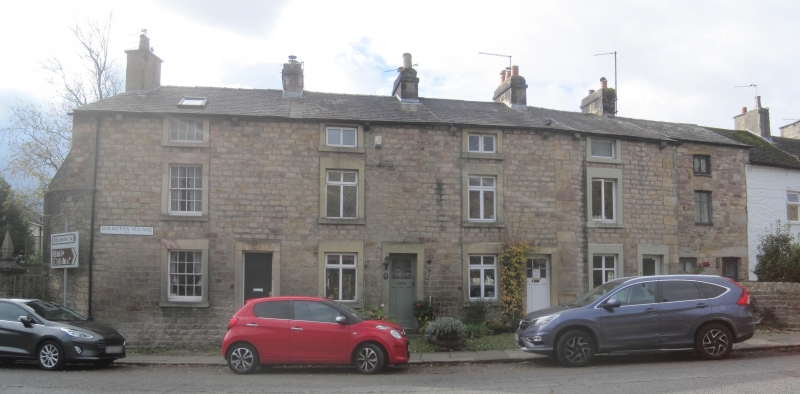
SD46SE WYRESDALE ROAD 1685-1/1/326 (West side) 18/02/70 Nos.7-10 (Consecutive) Golgotha (Formerly Listed as: WYRESDALE ROAD No.7, Golgotha) (Formerly Listed as: WYRESDALE ROAD No.8, Golgotha) (Formerly Listed as: WYRESDALE ROAD No.9, Golgotha) (Formerly Listed as: WYRESDALE ROAD No.10, Golgotha)
GV II
Row of 4 cottages. c1800, in 2 builds, altered C20. Watershot coursed squared sandstone rubble, now strap-pointed. Slate roof. 4 corniced ridge chimney stacks and a rebuilt chimney at the left gable. Rectangular double-depth plan, each cottage single-fronted. 3 storeys, each cottage of one bay. No.7 to the right has quoins at the right-hand corner and at the vertical joint with No.8 to the left. Each cottage has a doorway to the right and one window on each floor, the topmost very shallow. All these openings have raised punched surrounds. The windows mostly modern casements except No.10 at the left end, which has 12-pane sashes at ground and 1st floors and a 6-pane fixed window above. Moulded stone gutter brackets. Skylight window in roof of No.10. Masonry at left end of No.10 suggests that row formerly continued at this end. Rear: windows have raised sills and large lintels.
Listing NGR: SD4877260988
External links are from the relevant listing authority and, where applicable, Wikidata. Wikidata IDs may be related buildings as well as this specific building. If you want to add or update a link, you will need to do so by editing the Wikidata entry.


Other nearby listed buildings