Latitude: 54.0531 / 54°3'11"N
Longitude: -2.8047 / 2°48'16"W
OS Eastings: 347414
OS Northings: 462205
OS Grid: SD474622
Mapcode National: GBR 8PVK.LT
Mapcode Global: WH846.WDL5
Plus Code: 9C6V353W+64
Entry Name: Peel House
Listing Date: 18 February 1970
Last Amended: 13 March 1995
Grade: II
Source: Historic England
Source ID: 1298306
English Heritage Legacy ID: 383294
ID on this website: 101298306
Location: Lancaster, Lancashire, LA1
County: Lancashire
District: Lancaster
Electoral Ward/Division: Castle
Parish: Non Civil Parish
Built-Up Area: Lancaster
Traditional County: Lancashire
Lieutenancy Area (Ceremonial County): Lancashire
Church of England Parish: Lancaster St Mary with St John and St Anne
Church of England Diocese: Blackburn
Tagged with: House
LANCASTER
SD4762 ST GEORGE'S QUAY 1685-1/3/260 (South West side) 18/02/70 No.20 Peel House (Formerly Listed as: ST GEORGE'S QUAY No.20)
GV II
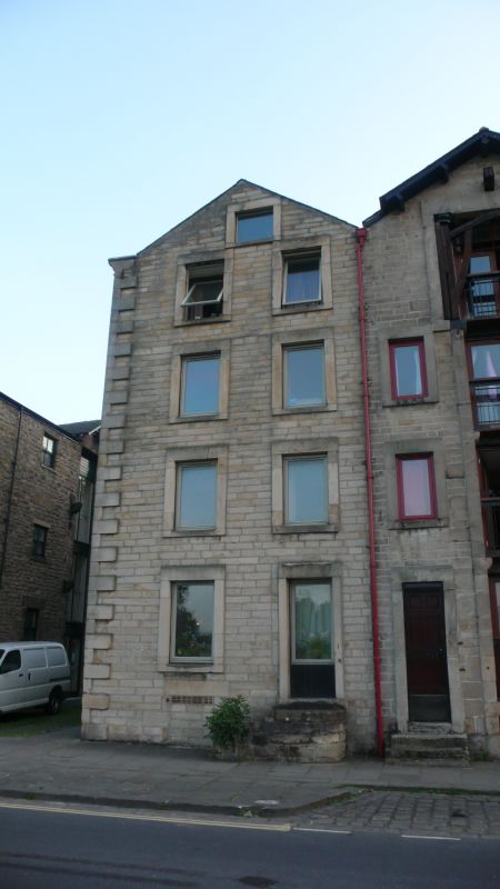
Warehouse, now flats. Mid C18, converted 1980. Squared coursed sandstone with slate roof. Approx 15m deep on plan behind a gabled facade which is approx 6m wide. 4 storeys plus attic and cellar, and 2 bays, with raised quoins to the left. The openings have plain stone surrounds and single-pane glazing inserted in 1980. Under the gable, which is coped with a kneeler, is a single attic window. The right-hand window on the ground floor is set within a blocked door surround, which has 5 external steps. The cellar opening is blocked. The left-hand return wall, facing Pine Street, has a loading slot which is now glazed.
Listing NGR: SD4741462205
External links are from the relevant listing authority and, where applicable, Wikidata. Wikidata IDs may be related buildings as well as this specific building. If you want to add or update a link, you will need to do so by editing the Wikidata entry.


Other nearby listed buildings