Latitude: 50.3952 / 50°23'42"N
Longitude: -3.5645 / 3°33'52"W
OS Eastings: 288892
OS Northings: 56202
OS Grid: SX888562
Mapcode National: GBR QT.VFV8
Mapcode Global: FRA 38F0.159
Plus Code: 9C2R9CWP+35
Entry Name: Vale House
Listing Date: 10 January 1975
Grade: II
Source: Historic England
Source ID: 1298269
English Heritage Legacy ID: 383619
ID on this website: 101298269
Location: Galmpton, Torbay, Devon, TQ5
County: Torbay
Electoral Ward/Division: Churston-with-Galmpton
Parish: Non Civil Parish
Built-Up Area: Paignton
Traditional County: Devon
Lieutenancy Area (Ceremonial County): Devon
Church of England Parish: Churston Ferrers St Mary the Virgin
Church of England Diocese: Exeter
Tagged with: House
BRIXHAM
SX8856SE GREENWAY ROAD, Galmpton 1946-1/9/67 (South East side) 10/01/75 No.23 Vale House
GV II
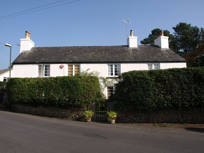
House, probably former farmhouse. C17 or earlier, remodelled and extended at rear early or mid C19. Solid rendered walls (stone rubble exposed inside); rear wing of painted stone rubble. Slated roof. Rendered chimneys on each gable end and on ridge, off-centre to right. 3-room through-passage plan; hall chimney at upper end with narrow inner room beyond. Added stair and kitchen wing at rear of hall. 2 storeys. 4 windows wide. Late C20 half-glazed wooden door. Windows have 2-light wood casements (probably late C20 replacements), each with 2 horizontal glazing bars per light. INTERIOR: hall has chamfered ceiling-beam without stops. Small fireplace with rebuilt lintel. C19 panelled corner cupboard. C19 wooden staircase with thin square balusters and column-newels. C19 kitchen has fireplace with segmental red-brick arch. Old plank door with strap-hinges to rear of through-passage.
Listing NGR: SX8889256202
External links are from the relevant listing authority and, where applicable, Wikidata. Wikidata IDs may be related buildings as well as this specific building. If you want to add or update a link, you will need to do so by editing the Wikidata entry.


Other nearby listed buildings