Latitude: 52.7549 / 52°45'17"N
Longitude: 0.3953 / 0°23'43"E
OS Eastings: 561749
OS Northings: 320168
OS Grid: TF617201
Mapcode National: GBR N3Q.BRH
Mapcode Global: WHJP7.10JV
Plus Code: 9F42Q93W+X4
Entry Name: 53, 53A, High Street
Listing Date: 7 June 1972
Grade: II
Source: Historic England
Source ID: 1298195
English Heritage Legacy ID: 384124
ID on this website: 101298195
Location: King's Lynn, King's Lynn and West Norfolk, Norfolk, PE30
County: Norfolk
District: King's Lynn and West Norfolk
Electoral Ward/Division: St Margarets with St Nicholas
Parish: Non Civil Parish
Built-Up Area: King's Lynn
Traditional County: Norfolk
Lieutenancy Area (Ceremonial County): Norfolk
Tagged with: Building
KING'S LYNN
TF6120SE HIGH STREET 610-1/7/55 (East side) 07/06/72 Nos.53 AND 53A
GV II
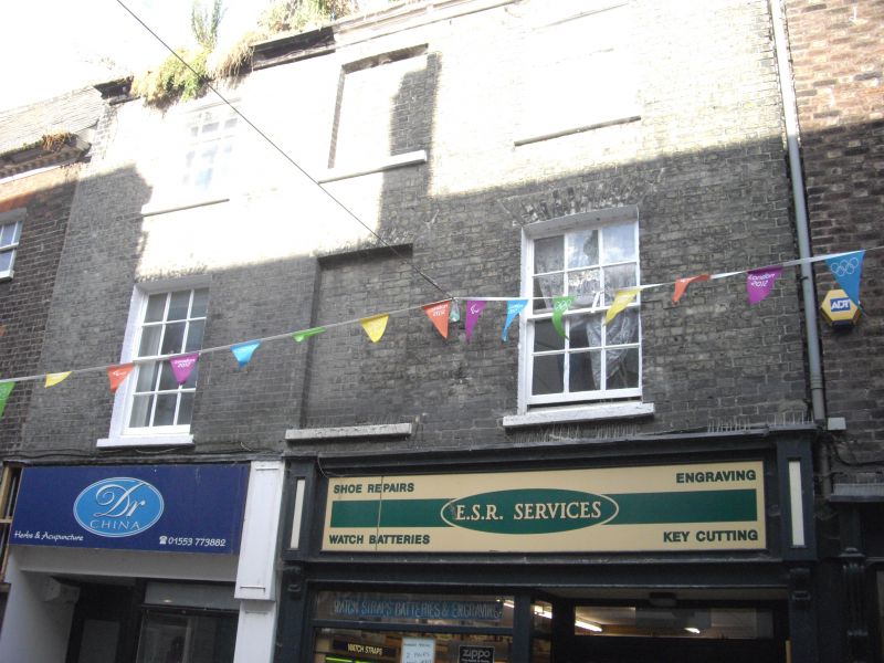
2 shops, but probably built as one. Flats over. Early C19. Gault brick. Roof not visible. 3 storeys in 3 bays. Two C20 shopfronts. Central bay of floors above defined by blind windows, otherwise sash windows with glazing bars and gauged skewback arches. Timber eaves cornice. Internal gable-end stacks.
Listing NGR: TF6174920167
External links are from the relevant listing authority and, where applicable, Wikidata. Wikidata IDs may be related buildings as well as this specific building. If you want to add or update a link, you will need to do so by editing the Wikidata entry.


Other nearby listed buildings