Latitude: 51.5487 / 51°32'55"N
Longitude: -0.1266 / 0°7'35"W
OS Eastings: 529995
OS Northings: 184974
OS Grid: TQ299849
Mapcode National: GBR FQ.2RP
Mapcode Global: VHGQS.RBFM
Plus Code: 9C3XGVXF+F9
Entry Name: Hungerford School
Listing Date: 30 September 1994
Grade: II
Source: Historic England
Source ID: 1298043
English Heritage Legacy ID: 369030
ID on this website: 101298043
Location: Lower Holloway, Islington, London, N7
County: London
District: Islington
Electoral Ward/Division: Holloway
Parish: Non Civil Parish
Built-Up Area: Islington
Traditional County: Middlesex
Lieutenancy Area (Ceremonial County): Greater London
Church of England Parish: St Luke West Holloway
Church of England Diocese: London
Tagged with: School building
ISLINGTON
TQ3085SW HUNGERFORD ROAD 635-1/35/996 (South East side) Hungerford School
II
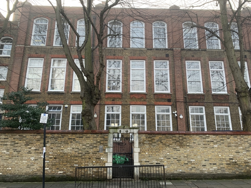
School. 1895-6. Designed by T.J. Bailey for the London School Board. Stock brick with red-brick dressings. Roofs of slate, except for tower roofs of lead and timber. Mainly 3-storeys. North-west front facing Hungerford Road consists of central range twelve windows wide topped by a parapet, connected by recessed and lower bays to pedimented end wings three windows wide. South-east front is more elaborate, with five-bay centre three storeys high surmounted by a hipped and slated roof and flanked by high twin towers capped by ogee-shaped roofs, balconies and ornamental cupolas; five-storey connecting bays left and right of the towers join on to three-storey pedimented wings, as on north-west front. School similar in type to Montem School, Hornsey Road (q.v.).
Listing NGR: TQ2999584974
External links are from the relevant listing authority and, where applicable, Wikidata. Wikidata IDs may be related buildings as well as this specific building. If you want to add or update a link, you will need to do so by editing the Wikidata entry.


Other nearby listed buildings