Latitude: 52.1861 / 52°11'9"N
Longitude: 0.9946 / 0°59'40"E
OS Eastings: 604808
OS Northings: 258428
OS Grid: TM048584
Mapcode National: GBR SJM.SC3
Mapcode Global: VHKDP.6B50
Plus Code: 9F425XPV+CR
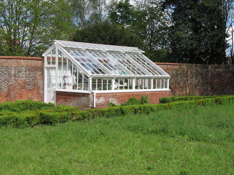
Entry Name: Abbot's Hall Enclosed Garden Walls and Attached Greenhouse
Listing Date: 19 April 1972
Last Amended: 29 November 1993
Grade: II
Source: Historic England
Source ID: 1297911
English Heritage Legacy ID: 384582
ID on this website: 101297911
Location: Stowmarket, Mid Suffolk, IP14
County: Suffolk
District: Mid Suffolk
Civil Parish: Stowmarket
Built-Up Area: Stowmarket
Traditional County: Suffolk
Lieutenancy Area (Ceremonial County): Suffolk
Church of England Parish: Stowmarket St Peter and St Mary
Church of England Diocese: St.Edmundsbury and Ipswich
Tagged with: Architectural structure
STOWMARKET
TM0458 CROWE STREET 614-1/4/58 Abbot's Hall: enclosed garden walls 19/04/72 and attached greenhouse (Formerly Listed as: CROWE STREET Walls of enclosed garden and wing walls of Abbott's Hall)
II
Walled garden. Mid C18. Red brick laid in Flemish bond. Some stretches with rounded brick coping. Lap-glazed greenhouse abuts north wall.
Listing NGR: TM0480858428
External links are from the relevant listing authority and, where applicable, Wikidata. Wikidata IDs may be related buildings as well as this specific building. If you want to add or update a link, you will need to do so by editing the Wikidata entry.


Other nearby listed buildings