Latitude: 53.7372 / 53°44'14"N
Longitude: -2.9566 / 2°57'23"W
OS Eastings: 336999
OS Northings: 427184
OS Grid: SD369271
Mapcode National: GBR 7TS7.Q1
Mapcode Global: WH85P.KBBB
Plus Code: 9C5VP2PV+V9
Entry Name: Attached Walls
Listing Date: 15 February 1993
Grade: II
Source: Historic England
Source ID: 1297674
English Heritage Legacy ID: 385319
ID on this website: 101297674
Location: Lytham, Fylde, Lancashire, FY8
County: Lancashire
District: Fylde
Electoral Ward/Division: Clifton
Parish: Lytham
Built-Up Area: Lytham St Anne's
Traditional County: Lancashire
Lieutenancy Area (Ceremonial County): Lancashire
Church of England Parish: Lytham St John the Divine
Church of England Diocese: Blackburn
Tagged with: Wall Terrace house
LYTHAM ST ANNES
SD3627SE STATION ROAD, Lytham 621-1/6/88 (East side) Nos.14-22 (Even) and attached walls
GV II
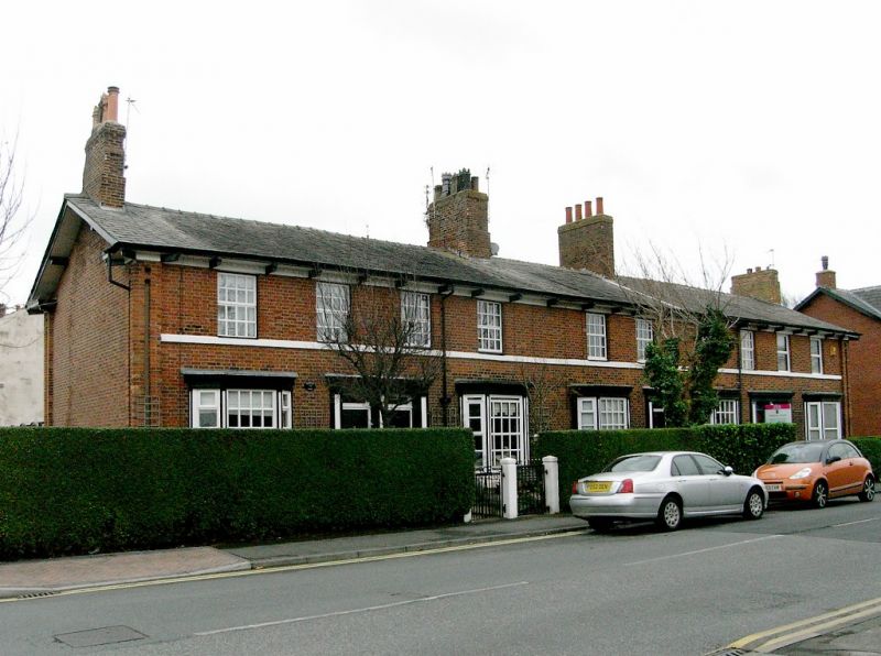
Terraced row of 5 small town houses. Probably c.1850-60; altered. Red brick in Flemish bond, with slate roof. Double-depth plan, each house single-fronted, entrance-halls adjoining pairs (except No.18 in the centre), with back extensions (coupled, single, coupled). Two low storeys, 2+2+2+2+2 windows, symmetrical; corner pilasters with narrow recessed panels, 1st-floor band, frieze with brick dentils and prominent straight brackets to projected eaves. Coupled, single and coupled doorways, all with panelled pilastered wooden architraves and dentilled cornices, and overlights (that at No.18 with gilt monogram "AM"). Unhorned sashed windows at Nos 16 and 22 (the former with glazing bars), but all other windows altered. Gable chimneys and 2 ridge chimneys. Rear: back yards of Nos 18, 20 and 22 enclosed by high walls built of large cobblestones.
Listing NGR: SD3699927184
External links are from the relevant listing authority and, where applicable, Wikidata. Wikidata IDs may be related buildings as well as this specific building. If you want to add or update a link, you will need to do so by editing the Wikidata entry.


Other nearby listed buildings