Latitude: 51.3071 / 51°18'25"N
Longitude: -1.0877 / 1°5'15"W
OS Eastings: 463686
OS Northings: 156835
OS Grid: SU636568
Mapcode National: GBR B5X.V52
Mapcode Global: VHD02.3D9V
Plus Code: 9C3W8W46+RW
Entry Name: Old Stable Block
Listing Date: 26 April 1957
Grade: I
Source: Historic England
Source ID: 1296934
English Heritage Legacy ID: 139037
ID on this website: 101296934
Location: Basingstoke and Deane, Hampshire, RG24
County: Hampshire
District: Basingstoke and Deane
Civil Parish: Sherborne St John
Traditional County: Hampshire
Lieutenancy Area (Ceremonial County): Hampshire
Church of England Parish: The Sherbornes with Pamber
Church of England Diocese: Winchester
Tagged with: Architectural structure
This list entry was subject to a Minor Amendment on 15 February 2024 to amend grade and to reformat the text to current standards.
SU 65 NW
5/83
SHERBORNE ST JOHN
VYNE PARK
Old Stable Block
26.4.57
I
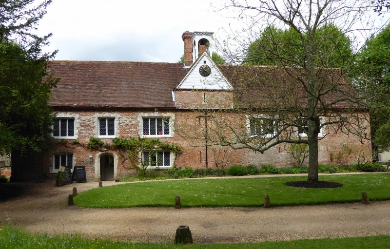
C16, C17, early C19. A two storeyed main block with a south east front, having north of the west end (forming less than a right-angle) a single storeyed wing with a small two storeyed crosswing at its north end (both of the last date). The generally symmetrical form of the main elevation is emphasised by a raised centre with a gable, surmounted by an open bell turret. The west side has three windows and a central doorway, the east has two high windows. Tiled roofs, brick dentil eaves, weather-boarded gabled with a clock face; above this an open wooden arched frame supporting a flat roof. Walling is in red brickwork, English bond, with stone dressings including rusticated flush quoins and flat arches, and a small moulded doorway with a four-centred arch. The east gable has a similar but larger doorway. The later extension (and the west gable of the main block) has brick dentils to the verge, and to a second floor string which rises in the middle as a hood-mould, the openings have rubbed flat arches, and there is a slightly-projecting gabled entrance in the centre. All windows are casements, with diagonal leaded lights.
Listing NGR: SU6271556115
External links are from the relevant listing authority and, where applicable, Wikidata. Wikidata IDs may be related buildings as well as this specific building. If you want to add or update a link, you will need to do so by editing the Wikidata entry.


Other nearby listed buildings