Latitude: 53.9309 / 53°55'51"N
Longitude: -2.1453 / 2°8'43"W
OS Eastings: 390555
OS Northings: 448319
OS Grid: SD905483
Mapcode National: GBR FQGZ.BM
Mapcode Global: WHB7D.0GPB
Plus Code: 9C5VWVJ3+9V
Entry Name: Thornton Hall Farmhouse
Listing Date: 31 October 1988
Grade: II
Source: Historic England
Source ID: 1296825
English Heritage Legacy ID: 324517
ID on this website: 101296825
Location: Thornton-in-Craven, North Yorkshire, BD23
County: North Yorkshire
District: Craven
Civil Parish: Thornton in Craven
Built-Up Area: Thornton-in-Craven
Traditional County: Yorkshire
Lieutenancy Area (Ceremonial County): North Yorkshire
Tagged with: Farmhouse
This list entry was subject to a Minor Amendment on 4 February 2026 to correct a typo in the name and address and to format the text to current standards
SD 9748
9/139
THORNTON-IN-CRAVEN
A56
Thornton Hall Farmhouse
II
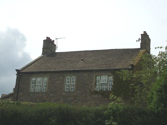
Farmhouse, later C18. Coursed rubble, stone slate roof. Two storeys, three bays. Modern door but with stone hood on consoles. To either side on each floor a three-light recessed square mullion window, with a similar two-light window over the door. Gable stacks.
Listing NGR: SD9055548319
External links are from the relevant listing authority and, where applicable, Wikidata. Wikidata IDs may be related buildings as well as this specific building. If you want to add or update a link, you will need to do so by editing the Wikidata entry.


Other nearby listed buildings