Latitude: 54.4517 / 54°27'6"N
Longitude: -1.2806 / 1°16'50"W
OS Eastings: 446739
OS Northings: 506498
OS Grid: NZ467064
Mapcode National: GBR MJHY.JY
Mapcode Global: WHD7K.9CDK
Plus Code: 9C6WFP29+MP
Entry Name: 29 North End
Listing Date: 8 May 1989
Grade: II
Source: Historic England
Source ID: 1294321
English Heritage Legacy ID: 333032
ID on this website: 101294321
Location: Hutton Rudby, North Yorkshire, TS15
County: North Yorkshire
District: Hambleton
Civil Parish: Hutton Rudby
Built-Up Area: Hutton Rudby
Traditional County: Yorkshire
Lieutenancy Area (Ceremonial County): North Yorkshire
Church of England Parish: Rudby-in-Cleveland All Saints
Church of England Diocese: York
Tagged with: Building
This list entry was subject to a Minor Amendment on 19 November 2025 to correct a typo in the description and to reformat the text to current standards
NZ 4606
13/103
HUTTON RUDBY
NORTH END (east side)
No 29
II
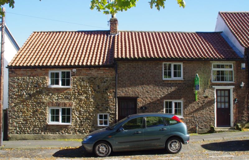
House, late C17 or early C18. Roughly-coursed sandstone rubble with red brick dressings; renewed pantiled roof, brick stack. Two storeys, two bays, irregular. Boarded door in front wall of No 27, beyond the chimney, suggesting a hearth-passage entry plan, the other part of which is now a separate dwelling. Ground floor has fire window, with fixed light, at right. Left three-light C20 one-bar casement, under gauged brick arch, and similar window above. Brick quoins and stepped-and-cogged eaves cornice. High-pitched roof with rebuilt right end chimney.
Listing NGR: NZ4673906498
External links are from the relevant listing authority and, where applicable, Wikidata. Wikidata IDs may be related buildings as well as this specific building. If you want to add or update a link, you will need to do so by editing the Wikidata entry.


Other nearby listed buildings