Latitude: 52.858 / 52°51'28"N
Longitude: -1.7271 / 1°43'37"W
OS Eastings: 418473
OS Northings: 328983
OS Grid: SK184289
Mapcode National: GBR 4BN.VJZ
Mapcode Global: WHCFY.FFT9
Plus Code: 9C4WV75F+65
Entry Name: Fauld Hall
Listing Date: 12 March 1964
Grade: II
Source: Historic England
Source ID: 1293729
English Heritage Legacy ID: 273623
ID on this website: 101293729
Location: Fauld, East Staffordshire, DE13
County: Staffordshire
District: East Staffordshire
Civil Parish: Hanbury
Traditional County: Staffordshire
Lieutenancy Area (Ceremonial County): Staffordshire
Church of England Parish: Hanbury St Werburgh
Church of England Diocese: Lichfield
Tagged with: House
HANBURY C.P. FAULD LANE, Fauld SK 12 NE Fauld Hall 2/44 12.3.64 - II
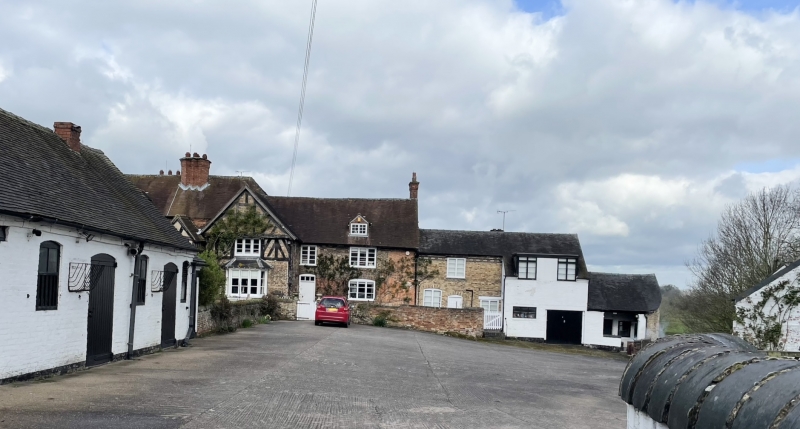
Manor house. Late C16, possibly with earlier core and late C18 and C19 additions and alterations. Part timber framed with brick infill and later wing in brickwork; tiled roofs. 3 diamond-shaped shafted centre ridge stack and end stacks. Complex plan built up from original hall and cross- wing. Hall now mainly replaced by C18 work to west with C19 wing built up against east side of cross-wing forming an elongated cross. Cross- wing now central to composition, gabled, 2 storeys with diagonal framing, originally lozenge-pattern within panels; corbelled gable; 3-light casement window to centre of first floor over 3-sided hipped bay to ground; adjacent to left is a 2-storey gabled porch, jettied to first floor, diagonal braces to truss; central C20 two-light casement window over wide-boarded door with strap hinges and ring knocker. Wing set- back to left on hall side behind porch and built up against gabled dormers of 2 storeys and attic (eaves raised C20) and 2 windows, C20 gabled dormers over C20 concrete lintel casements of unequal depths and single 2-light segmental-head casement window to ground floor right. Wing set well back to right of timber framed gable is of 2 storeys and attic, and 2 casement windows (one dormer to right) with farm entrance set against angle to left. Attached cottage to right of lower ridge not included.
Listing NGR: SK1847328983
External links are from the relevant listing authority and, where applicable, Wikidata. Wikidata IDs may be related buildings as well as this specific building. If you want to add or update a link, you will need to do so by editing the Wikidata entry.


Other nearby listed buildings