Latitude: 54.2959 / 54°17'45"N
Longitude: -1.3249 / 1°19'29"W
OS Eastings: 444036
OS Northings: 489131
OS Grid: SE440891
Mapcode National: GBR ML5R.YS
Mapcode Global: WHD89.M990
Plus Code: 9C6W7MWG+92
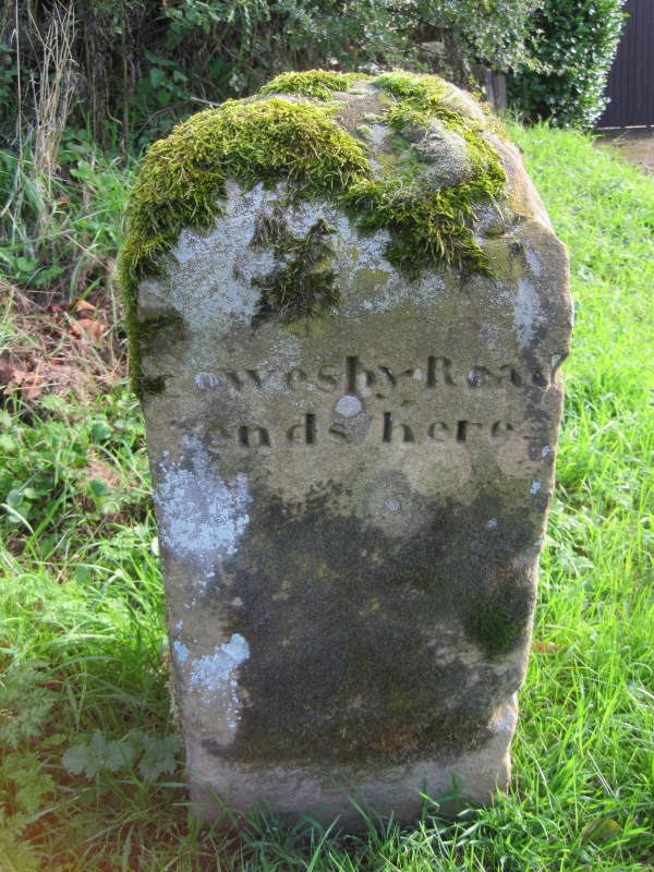
Entry Name: Boundary Stone on East Side of Junction with Cophill Lane
Listing Date: 2 February 1990
Grade: II
Source: Historic England
Source ID: 1293659
English Heritage Legacy ID: 332540
ID on this website: 101293659
Location: North Yorkshire, YO7
County: North Yorkshire
District: Hambleton
Civil Parish: Cowesby
Traditional County: Yorkshire
Lieutenancy Area (Ceremonial County): North Yorkshire
Tagged with: Boundary marker
COWESBY DELF LANE SE 48 NW (WEST SIDE) 3/13 Boundary stone on east side of junction with Cophill Lane GV II Boundary Stone. Early C19. Stone monolith, square on plan, with chamfered top. Well-cut lettering on west face reads "COWESBY ROAD/ends here" and on south face "The Manor/and Township/of Cowesby/end here".
Listing NGR: SE4403689131
External links are from the relevant listing authority and, where applicable, Wikidata. Wikidata IDs may be related buildings as well as this specific building. If you want to add or update a link, you will need to do so by editing the Wikidata entry.


Other nearby listed buildings