Latitude: 51.4676 / 51°28'3"N
Longitude: -2.568 / 2°34'4"W
OS Eastings: 360638
OS Northings: 174440
OS Grid: ST606744
Mapcode National: GBR CGD.3R
Mapcode Global: VH88N.FCRT
Plus Code: 9C3VFC9J+2Q
Entry Name: 332 and 334, Stapleton Road
Listing Date: 4 March 1977
Grade: II
Source: Historic England
Source ID: 1293000
English Heritage Legacy ID: 380598
ID on this website: 101293000
Location: Upper Easton, Bristol, BS5
County: City of Bristol
Electoral Ward/Division: Lawrence Hill
Parish: Non Civil Parish
Built-Up Area: Bristol
Traditional County: Gloucestershire
Lieutenancy Area (Ceremonial County): Bristol
Church of England Parish: Bristol St Paul's
Church of England Diocese: Bristol
Tagged with: Building
BRISTOL
ST6074 STAPLETON ROAD, Easton 901-1/37/1246 (West side) 04/03/77 Nos.332 AND 334
GV II
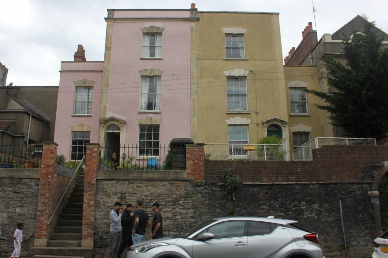
Pair of terraced houses. Early C19. Render with limestone dressings and pantile roof. Double-depth plan. 3 storeys; 4-window range. A balanced pair, with lower side blocks set back from the front, and a pilastered centre with a cornice and parapet. Windows with 5 stepped voussoirs and some 6/6 pane sashes. Bracketed canopy over a round-headed doorway and fanlight to the right of the central block, and plain doorway in the left wing. INTERIOR not inspected.
Listing NGR: ST6063874440
External links are from the relevant listing authority and, where applicable, Wikidata. Wikidata IDs may be related buildings as well as this specific building. If you want to add or update a link, you will need to do so by editing the Wikidata entry.


Other nearby listed buildings