Latitude: 52.4855 / 52°29'7"N
Longitude: -1.2555 / 1°15'19"W
OS Eastings: 450652
OS Northings: 287772
OS Grid: SP506877
Mapcode National: GBR 8P7.1DX
Mapcode Global: VHCT5.6S3G
Plus Code: 9C4WFPPV+6Q
Entry Name: Ullesthorpe Mill
Listing Date: 2 November 1972
Grade: II
Source: Historic England
Source ID: 1292776
English Heritage Legacy ID: 392599
ID on this website: 101292776
Location: Ullesthorpe, Harborough, Leicestershire, LE17
County: Leicestershire
District: Harborough
Civil Parish: Ullesthorpe
Built-Up Area: Ullesthorpe
Traditional County: Leicestershire
Lieutenancy Area (Ceremonial County): Leicestershire
Church of England Parish: Claybrooke St Peter
Church of England Diocese: Leicester
Tagged with: Tower mill
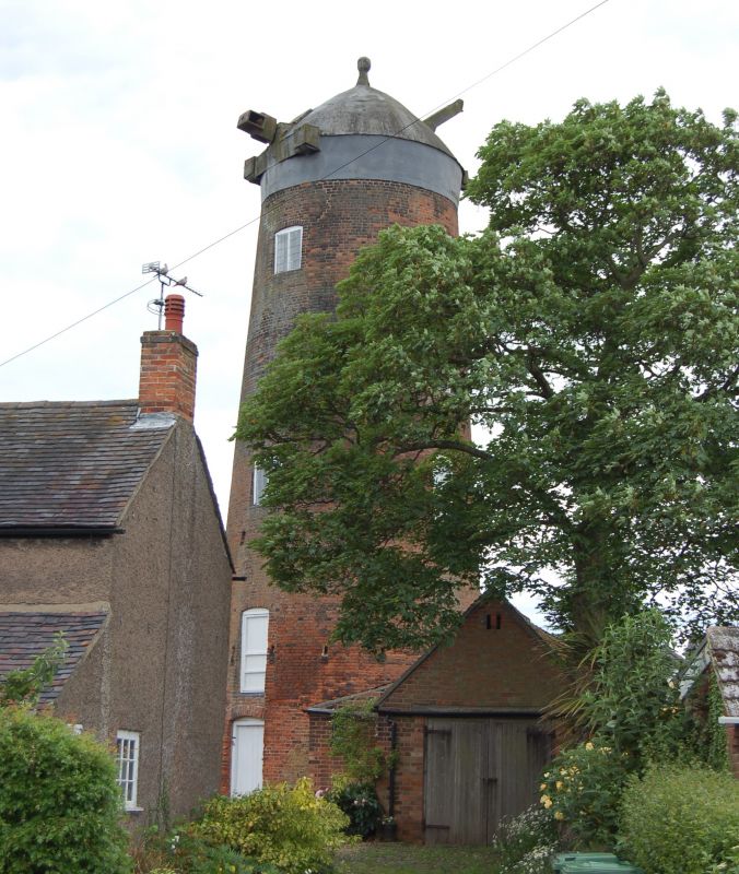
ULLESTHORPE MILL ROAD SP58NW 1323-0/3/104 (West side) 02/11/72 Ullesthorpe Mill II
Windmill tower. Built by subscription 1800. Round red brick tower with batter and slight bell-cast. Creosoted iron pepperpot cap, rounded with finial. Drive-shaft still in existence. Door on ground floor to south-east with one on first floor above and one second floor to north-east, all boarded. Various leaded casements on different floors, all in segment-headed openings. Interior: machinery more or less intact, including shafting, wallower, spur wheel, grain nuts and shafts, bins and hoists.
Listing NGR: SP5065687755
External links are from the relevant listing authority and, where applicable, Wikidata. Wikidata IDs may be related buildings as well as this specific building. If you want to add or update a link, you will need to do so by editing the Wikidata entry.


Other nearby listed buildings