Latitude: 53.1629 / 53°9'46"N
Longitude: -1.4807 / 1°28'50"W
OS Eastings: 434815
OS Northings: 362994
OS Grid: SK348629
Mapcode National: GBR 69Y.QFW
Mapcode Global: WHDFN.7R4L
Plus Code: 9C5W5G79+5P
Entry Name: Ashcroft Ashcroft Cottage
Listing Date: 30 August 1995
Grade: II
Source: Historic England
Source ID: 1291951
English Heritage Legacy ID: 393423
ID on this website: 101291951
Location: Ashover, North East Derbyshire, S45
County: Derbyshire
District: North East Derbyshire
Civil Parish: Ashover
Built-Up Area: Ashover
Traditional County: Derbyshire
Lieutenancy Area (Ceremonial County): Derbyshire
Church of England Parish: Ashover All Saints
Church of England Diocese: Derby
Tagged with: Cottage
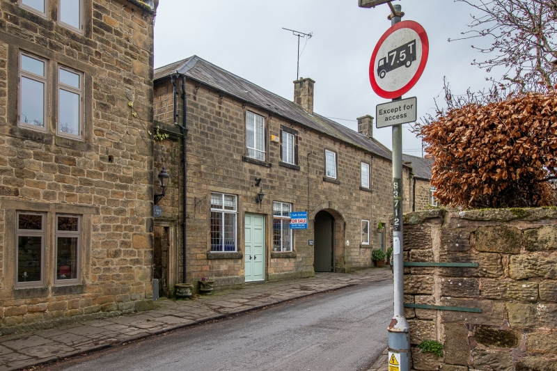
AS HOVER SK3462 BUTTS ROAD 1264-0/12/14 (South side) Ashcroft & Ashcroft Cottage GV II Pair of houses. Late C18, with C19 remodelling and C20 alterations. Ashlar gritstone with coped gable to west end, and a hipped end to the east. A ridge and gable stack, both ashlar, and a Welsh slate roof. 2 storeys and 5 bays, with a central segmentally arched carriage entrance, with ashlar voussoirs and advanced keyblock. Doorway to eastern part with plain jambs and lintel, flanked by taller 2-light windows with flush surrounds and metal frames with transoms. To the west of the archway are 2-light windows and a doorway between, all with flush surrounds. The first floor has five 2-light casement windows in flush surrounds, that to the east end taller than the remainder. Listed for Group Value.
Listing NGR: SK3481562993
External links are from the relevant listing authority and, where applicable, Wikidata. Wikidata IDs may be related buildings as well as this specific building. If you want to add or update a link, you will need to do so by editing the Wikidata entry.


Other nearby listed buildings