Latitude: 54.5413 / 54°32'28"N
Longitude: -1.9243 / 1°55'27"W
OS Eastings: 404994
OS Northings: 516229
OS Grid: NZ049162
Mapcode National: GBR HH0X.5V
Mapcode Global: WHB4L.D3WW
Plus Code: 9C6WG3RG+G7
Entry Name: 29, the Bank
Listing Date: 22 February 1973
Last Amended: 28 November 1994
Grade: II
Source: Historic England
Source ID: 1291805
English Heritage Legacy ID: 388825
ID on this website: 101291805
Location: Startforth, County Durham, DL12
County: County Durham
Civil Parish: Barnard Castle
Built-Up Area: Barnard Castle
Traditional County: Durham
Lieutenancy Area (Ceremonial County): County Durham
Church of England Parish: Barnard Castle with Whorlton
Church of England Diocese: Durham
Tagged with: Building
BARNARD CASTLE
NZ0416SE THE BANK 770-1/5/196 (West side) 22/02/73 No.29 (Formerly Listed as: THE BANK (West side) Nos.1-17, 23-29 (Odd) and The Old Well)
GV II
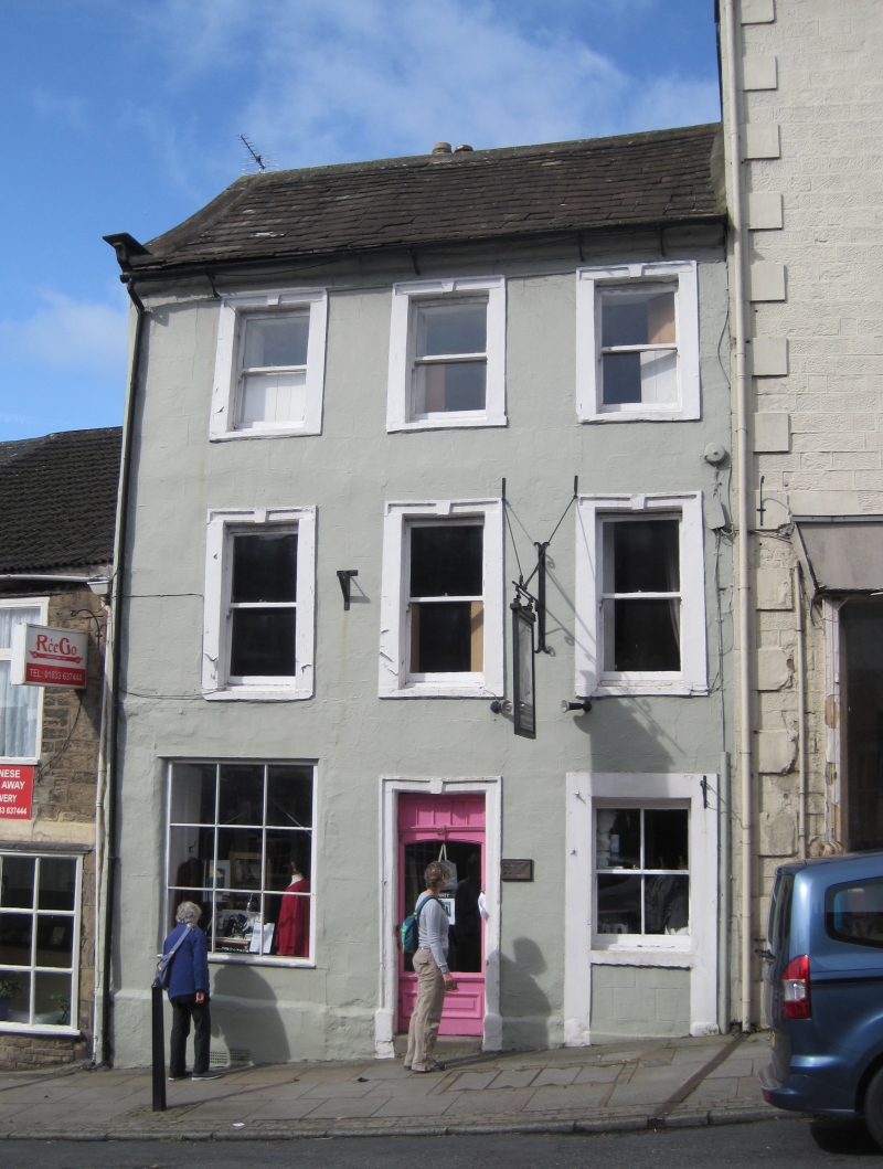
House, now shop and flat. Early C18 incorporating earlier fabric, with C19 and C20 alterations. Painted incised stucco with painted ashlar dressings; roof of stone slates with stone gable coping and chimney. 3 storeys; 3-window range. Left ground floor window enlarged at unknown date to plate-glass display window without features. Tooled painted stone surround at right to door now blocked and with 4-pane sash inserted. Central keyed architrave, originally a window, has half-glazed shop door and 5-pane overlight inserted. Similar keyed heads and plain jambs and sills to plain sashes on upper floors, those on top floor smaller. Cyma recta eaves gutter cornice. Roof has left gable coping on cyma-moulded kneeler; chimney at rear eaves barely visible. INTERIOR: wide elliptical stone lintel, possibly C16, in cellar; diagonal fireplaces in rear left corner on each floor; full-height bowed recess adjacent to fireplace, possibly formerly accommodating cupboard on each floor; dogleg stair with C17 door to roof space. Roof trusses have upper crucks with 2 levels of purlins.
Listing NGR: NZ0499116229
External links are from the relevant listing authority and, where applicable, Wikidata. Wikidata IDs may be related buildings as well as this specific building. If you want to add or update a link, you will need to do so by editing the Wikidata entry.


Other nearby listed buildings