Latitude: 54.5414 / 54°32'28"N
Longitude: -1.9238 / 1°55'25"W
OS Eastings: 405026
OS Northings: 516238
OS Grid: NZ050162
Mapcode National: GBR HH0X.9T
Mapcode Global: WHB4L.F34V
Plus Code: 9C6WG3RG+HF
Entry Name: 24, the Bank
Listing Date: 22 February 1973
Last Amended: 28 November 1994
Grade: II
Source: Historic England
Source ID: 1291798
English Heritage Legacy ID: 388821
ID on this website: 101291798
Location: Startforth, County Durham, DL12
County: County Durham
Civil Parish: Barnard Castle
Built-Up Area: Barnard Castle
Traditional County: Durham
Lieutenancy Area (Ceremonial County): County Durham
Church of England Parish: Barnard Castle with Whorlton
Church of England Diocese: Durham
Tagged with: Building
BARNARD CASTLE
NZ0516SW THE BANK 770-1/6/192 (East side) 22/02/73 No.24 (Formerly Listed as: BARNARD CSTLE THE BANK (East side) Nos.22-26, 26A AND 28 (Even) Rear wing, coachhouse, cobbled drive and yard, all at rear of No.22)
GV II
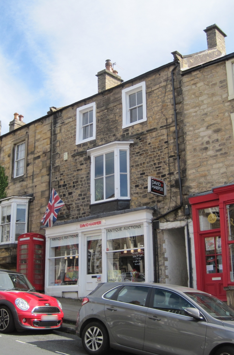
House, now shop and flat. Probably mid-late C18 with late C19 alterations and shop. Irregular courses of squared stone with ashlar quoins and dressings; Welsh slate roof with stone gable copings and yellow brick chimneys. 3 storeys; one-window range. Internal steps up at right to open passage leading to West View, former Methodist Chapel (qv). Shop front has central door, windows with central transom, panelled pilasters with paterae, and boarded fascia and cornice. First floor has fragment of floor band at left, and central C19 canted bay window with 4-pane sashes, chamfered mullions, and corniced flat roof. Second floor has floor band, damaged at left, and similar sashes in 2 windows with painted stone surrounds rising through band at former eaves, now raised in more uniform masonry. Roof has stone gable copings resting on moulded kneelers; corniced end chimneys. INTERIOR: not inspected.
Listing NGR: NZ0502816238
External links are from the relevant listing authority and, where applicable, Wikidata. Wikidata IDs may be related buildings as well as this specific building. If you want to add or update a link, you will need to do so by editing the Wikidata entry.


Other nearby listed buildings