Latitude: 52.9021 / 52°54'7"N
Longitude: -2.1471 / 2°8'49"W
OS Eastings: 390205
OS Northings: 333863
OS Grid: SJ902338
Mapcode National: GBR 15Q.3YX
Mapcode Global: WHBDD.ZBR0
Plus Code: 9C4VWV23+R5
Entry Name: 36, High Street
Listing Date: 27 July 1972
Grade: II
Source: Historic England
Source ID: 1291632
English Heritage Legacy ID: 386002
ID on this website: 101291632
Location: Stone, Stafford, Staffordshire, ST15
County: Staffordshire
District: Stafford
Civil Parish: Stone
Built-Up Area: Stone
Traditional County: Staffordshire
Lieutenancy Area (Ceremonial County): Staffordshire
Church of England Parish: Stone St Michael and St Wulfad
Church of England Diocese: Lichfield
Tagged with: Building
STONE
SJ9033 HIGH STREET, Stone 651-1/7/30 (South West side) 27/07/72 No.36
GV II
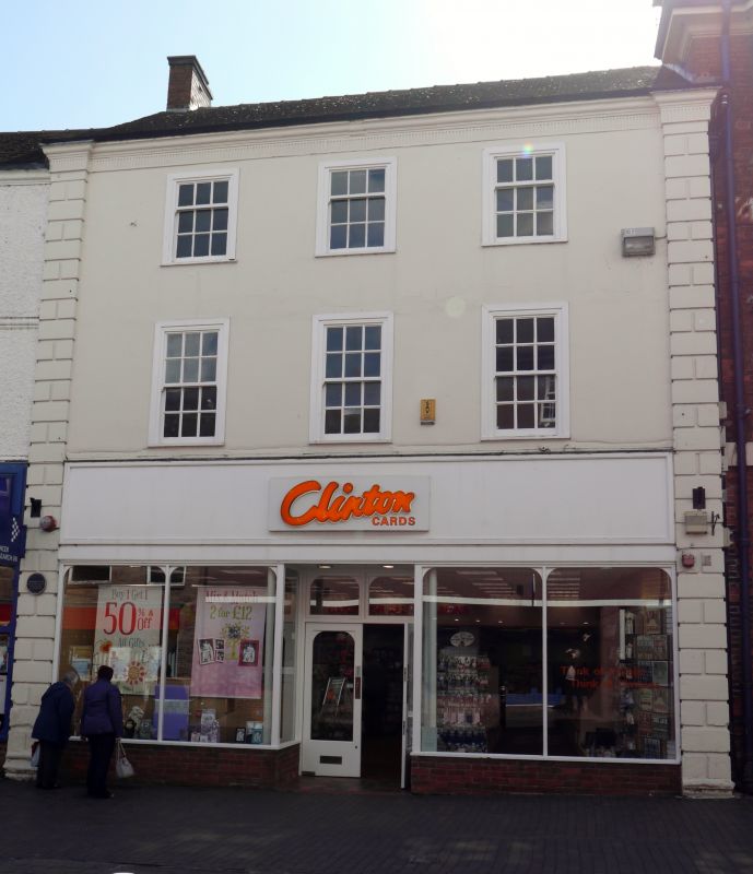
Shop. c1770. Stucco; tile roof with brick cross-axial stack. Double-depth plan. Georgian style. 3 storeys; 3-window range. Rusticated end pilasters; top cornice. C20 shop front. Windows to upper floors have architraves, 12-pane sashes to first floor, 9-pane sashes to 2nd floor.
Listing NGR: SJ9020533862
External links are from the relevant listing authority and, where applicable, Wikidata. Wikidata IDs may be related buildings as well as this specific building. If you want to add or update a link, you will need to do so by editing the Wikidata entry.


Other nearby listed buildings