Latitude: 50.8069 / 50°48'24"N
Longitude: -2.7379 / 2°44'16"W
OS Eastings: 348098
OS Northings: 101077
OS Grid: ST480010
Mapcode National: GBR MJ.YJ4Y
Mapcode Global: FRA 564Y.Z0G
Plus Code: 9C2VR746+QR
Entry Name: Woodlands
Listing Date: 22 December 1983
Grade: II
Source: Historic England
Source ID: 1291420
English Heritage Legacy ID: 105078
ID on this website: 101291420
Location: Beaminster, Dorset, DT8
County: Dorset
Civil Parish: Beaminster
Built-Up Area: Beaminster
Traditional County: Dorset
Lieutenancy Area (Ceremonial County): Dorset
Church of England Parish: Beaminster St Mary of the Annunciation
Church of England Diocese: Salisbury
Tagged with: Building
BEAMINSTER BRIDPORT ROAD ST4701/4801 (EAST SIDE) 7/18 No 9 (Woodlands) GV II
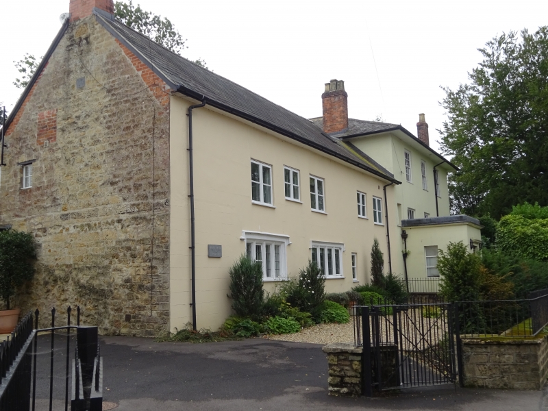
Detached House, now school boarding-house. C17 north range and early C19 south block. Stone walls, rendered. Slate roofs with a tile ridge. Brick stacks at left hand gable and 2 stacks on right hand roof hips. North range: 2 storeys. 4 windows, two 4-light stone mullions (ovolos), left hand: C17 with label; right hand is a C20 replacement. Remainder are 2 and 3-light wooden casements. South block, C19, 2 storeys on cellars. 3 windows, sashes with glazing-bars, wooden cills. Large square rendered porch with a flat top. Front door to porch, with 2 panels and marginal glazing-bars above. C19, Garden front: 2 4-light French windows with marginal glazing-bars. Glass-topped verandah on iron columns. Upper storey windows: of "French-window" type with marginal glazing-bars. 3 iron balconies on brackets. Source: R.C.H.M. Dorset I, p 24(13).
Listing NGR: ST4810701084
External links are from the relevant listing authority and, where applicable, Wikidata. Wikidata IDs may be related buildings as well as this specific building. If you want to add or update a link, you will need to do so by editing the Wikidata entry.


Other nearby listed buildings