Latitude: 53.2621 / 53°15'43"N
Longitude: -2.1292 / 2°7'45"W
OS Eastings: 391475
OS Northings: 373910
OS Grid: SJ914739
Mapcode National: GBR FZKQ.TB
Mapcode Global: WHBBP.88BJ
Plus Code: 9C5V7V6C+R8
Entry Name: Stanleys Almshouses
Listing Date: 17 March 1977
Grade: II
Source: Historic England
Source ID: 1291285
English Heritage Legacy ID: 391020
ID on this website: 101291285
Location: Macclesfield, Cheshire East, Cheshire, SK10
County: Cheshire East
Civil Parish: Macclesfield
Built-Up Area: Macclesfield
Traditional County: Cheshire
Lieutenancy Area (Ceremonial County): Cheshire
Church of England Parish: St Michael and All Angels, Macclesfield
Church of England Diocese: Chester
Tagged with: Almshouse
MACCLESFIELD
SJ9173NW KING EDWARD STREET 886-1/9/114 (West side) 17/03/77 Stanley's Almshouses, Nos.1-12 (Consecutive)
GV II
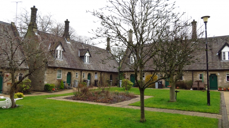
Almshouses. 1871 and 1927, with late C20 alterations and additions. Coursed and squared rubble with heavy slate roofs. 4 blocks forming 3 sides of a courtyard. Domestic Gothic style. Original buildings form the E and SE part of the court, the scheme completed with the addition of 2 further blocks in 1927, one extending the range to Cumberland Street, the other at right angles to it. Single-storeyed originally, with 4-light mullioned windows with shaped lights in outer walls; remodelled on courtyard side in conjunction with alterations to internal planning. Shouldered lintels andd 2-light mullioned windows, the stone heads re-used and re-cut. Gabled dormers in roof added 1992. Stacks reconstructed 1992. Pointed archway with castellated parapet links the 2 original buildings and forms the entrance to the courtyard.
Listing NGR: SJ9166473846
External links are from the relevant listing authority and, where applicable, Wikidata. Wikidata IDs may be related buildings as well as this specific building. If you want to add or update a link, you will need to do so by editing the Wikidata entry.


Other nearby listed buildings