Latitude: 54.1428 / 54°8'34"N
Longitude: -0.7794 / 0°46'45"W
OS Eastings: 479835
OS Northings: 472578
OS Grid: SE798725
Mapcode National: GBR RN0J.2N
Mapcode Global: WHFBH.044C
Plus Code: 9C6X46VC+47
Entry Name: Holgate's House
Listing Date: 10 June 1974
Last Amended: 5 April 1993
Grade: II
Source: Historic England
Source ID: 1291164
English Heritage Legacy ID: 389525
ID on this website: 101291164
Location: Old Malton, North Yorkshire, YO17
County: North Yorkshire
District: Ryedale
Civil Parish: Malton
Built-Up Area: Malton
Traditional County: Yorkshire
Lieutenancy Area (Ceremonial County): North Yorkshire
Church of England Parish: Old Malton St Mary the Virgin
Church of England Diocese: York
Tagged with: House
MALTON
SE7872 TOWN STREET, Old Malton 801-1/6/204 (South East side) 10/06/74 No.18 Holgate's House (Formerly Listed as: TOWN STREET (South East side) No.18 The Bungalow)
GV II
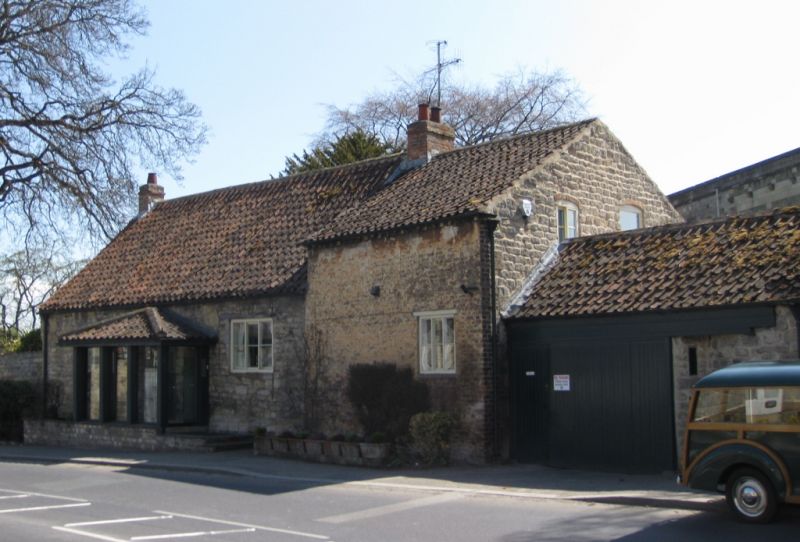
House, incorporating remains of Malton Grammar School. C16 origins, with late C18 alteration and coach-house and stable extension; further extension and modernisation in C20. Earlier part of rubble stone; extension of stretcher bond brick, formerly painted, refaced in coursed stone; pantile roof with brick stacks. 1-storey 3-bay front, with 1-storey 2-bay extension to right. House entrance in right return of extension. Blocked former entrance in centre bay of C17 part, between 3-light large pane sliding sashes with timber lintels. Extension has one similar window in right bay, and cogged eaves course.
Listing NGR: SE7983672575
External links are from the relevant listing authority and, where applicable, Wikidata. Wikidata IDs may be related buildings as well as this specific building. If you want to add or update a link, you will need to do so by editing the Wikidata entry.


Other nearby listed buildings