Latitude: 51.4163 / 51°24'58"N
Longitude: -1.5149 / 1°30'53"W
OS Eastings: 433829
OS Northings: 168695
OS Grid: SU338686
Mapcode National: GBR 706.1V2
Mapcode Global: VHC1S.PNHN
Plus Code: 9C3WCF8P+G2
Entry Name: 5, High Street
Listing Date: 10 September 1951
Grade: II
Source: Historic England
Source ID: 1290397
English Heritage Legacy ID: 395174
ID on this website: 101290397
Location: Hungerford, West Berkshire, RG17
County: West Berkshire
Civil Parish: Hungerford
Built-Up Area: Hungerford
Traditional County: Berkshire
Lieutenancy Area (Ceremonial County): Berkshire
Church of England Parish: Hungerford with Denford
Church of England Diocese: Oxford
Tagged with: Building
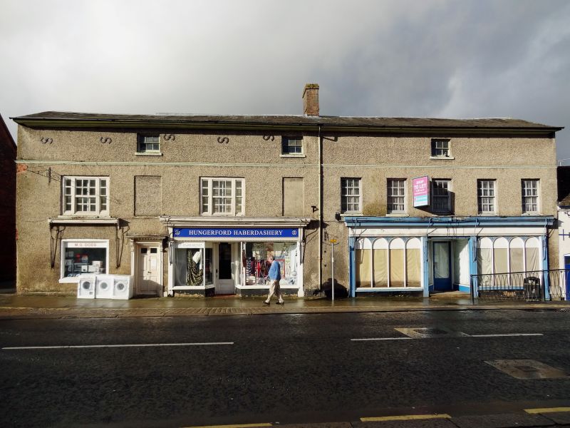
HUNGERFORD HIGH STREET (West side) SU 3368 18/35 No.5 10.9.51 G.V. II House, now house and shop. Mid C18, altered in early C19. Tiled roof end chimney to left and central chimney, flank wall flint with brick bands, front wall rough cast with eaves cornice and moulded band at second floor (former eaves level).3 storeys. 3 small glazing bar sashes at second floor, 2 tripartite glazing bar sashes alternating with narrow blank recesses to left, 5 glazing bar sashes to right, ground floor has plain shop window to left, 6 panel door with flat hood on cut bracket. 2 late C19 shop fronts with deep fascias and moulded cornices.
Listing NGR: SU3382968695
External links are from the relevant listing authority and, where applicable, Wikidata. Wikidata IDs may be related buildings as well as this specific building. If you want to add or update a link, you will need to do so by editing the Wikidata entry.


Other nearby listed buildings